NM24 NewMexico24 - Earthquake Result Viewer
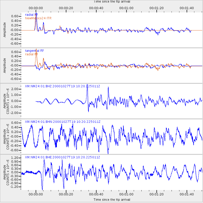
Earthquake location: Leeward Islands
Earthquake latitude/longitude: 17.6/-61.2
Earthquake time(UTC): 2000/10/27 (301) 19:02:52 GMT
Earthquake Depth: 38 km
Earthquake Magnitude: 5.4 MB, 5.3 MS, 5.8 MW, 5.6 MW
Earthquake Catalog/Contributor: WHDF/NEIC
Network: XM Rio Grande Seismic Transect
Station: NM24 NewMexico24
Lat/Lon: 34.05 N/106.12 W
Elevation: 1874 m
Distance: 43.3 deg
Az: 301.183 deg
Baz: 100.664 deg
Ray Param: 0.07257697
Estimated Moho Depth: 42.5 km
Estimated Crust Vp/Vs: 1.73
Assumed Crust Vp: 6.502 km/s
Estimated Crust Vs: 3.764 km/s
Estimated Crust Poisson's Ratio: 0.25
Radial Match: 82.33152 %
Radial Bump: 400
Transverse Match: 57.25903 %
Transverse Bump: 400
SOD ConfigId: 16820
Insert Time: 2010-02-26 17:33:51.509 +0000
GWidth: 2.5
Max Bumps: 400
Tol: 0.001

Signal To Noise

ChannelStoNSTALTA
XM:NM24:01:BHN:20001027T19:10:20.225011Z1.06180683.3224012E-73.1290074E-7
XM:NM24:01:BHE:20001027T19:10:20.225011Z3.85076624.5584275E-71.1837716E-7
XM:NM24:01:BHZ:20001027T19:10:20.225011Z3.6595059.32093E-72.5470467E-7
Arrivals
Ps5.1 SECOND
PpPs17 SECOND
PsPs/PpSs22 SECOND