NM24 NewMexico24 - Earthquake Result Viewer
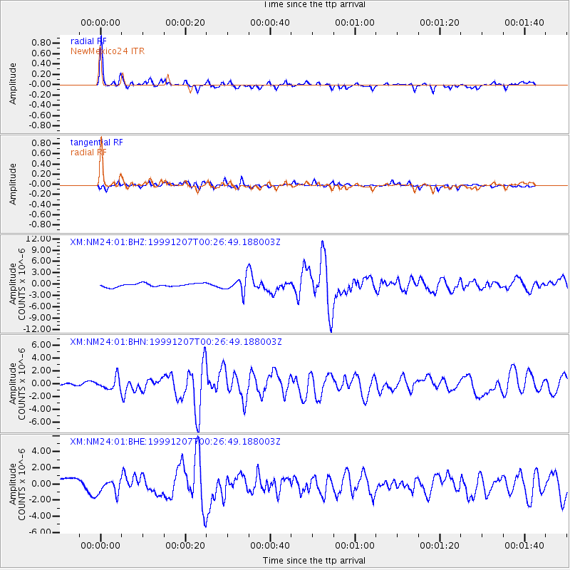
Earthquake location: Kodiak Island Region, Alaska
Earthquake latitude/longitude: 57.4/-154.5
Earthquake time(UTC): 1999/12/07 (341) 00:19:49 GMT
Earthquake Depth: 41 km
Earthquake Magnitude: 6.5 MB, 6.1 MS, 6.4 MW, 6.3 ML
Earthquake Catalog/Contributor: WHDF/NEIC
Network: XM Rio Grande Seismic Transect
Station: NM24 NewMexico24
Lat/Lon: 34.05 N/106.12 W
Elevation: 1874 m
Distance: 39.9 deg
Az: 104.569 deg
Baz: 320.828 deg
Ray Param: 0.07461191
Estimated Moho Depth: 48.25 km
Estimated Crust Vp/Vs: 1.63
Assumed Crust Vp: 6.502 km/s
Estimated Crust Vs: 3.989 km/s
Estimated Crust Poisson's Ratio: 0.20
Radial Match: 85.33045 %
Radial Bump: 272
Transverse Match: 78.54988 %
Transverse Bump: 400
SOD ConfigId: 27569
Insert Time: 2010-02-26 17:33:59.350 +0000
GWidth: 2.5
Max Bumps: 400
Tol: 0.001

Signal To Noise

ChannelStoNSTALTA
XM:NM24:01:BHN:19991207T00:26:49.188003Z1.55775349.40742E-76.039094E-7
XM:NM24:01:BHE:19991207T00:26:49.188003Z1.80323988.888606E-74.9292424E-7
XM:NM24:01:BHZ:19991207T00:26:49.188003Z4.688312.0758273E-64.4276663E-7
Arrivals
Ps5.1 SECOND
PpPs18 SECOND
PsPs/PpSs23 SECOND