TX03 Texas03 - Earthquake Result Viewer
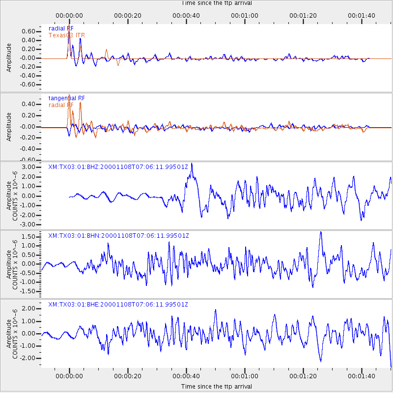
Earthquake location: Panama-Colombia Border Region
Earthquake latitude/longitude: 7.0/-77.8
Earthquake time(UTC): 2000/11/08 (313) 06:59:58 GMT
Earthquake Depth: 17 km
Earthquake Magnitude: 6.0 MB, 6.4 MS, 6.5 MW, 6.2 ML
Earthquake Catalog/Contributor: WHDF/NEIC
Network: XM Rio Grande Seismic Transect
Station: TX03 Texas03
Lat/Lon: 31.62 N/103.32 W
Elevation: 831 m
Distance: 34.1 deg
Az: 319.115 deg
Baz: 130.398 deg
Ray Param: 0.07787703
Estimated Moho Depth: 10.0 km
Estimated Crust Vp/Vs: 1.62
Assumed Crust Vp: 6.121 km/s
Estimated Crust Vs: 3.784 km/s
Estimated Crust Poisson's Ratio: 0.19
Radial Match: 87.83409 %
Radial Bump: 400
Transverse Match: 45.84423 %
Transverse Bump: 400
SOD ConfigId: 3744
Insert Time: 2010-02-26 17:34:06.225 +0000
GWidth: 2.5
Max Bumps: 400
Tol: 0.001

Signal To Noise

ChannelStoNSTALTA
XM:TX03:01:BHN:20001108T07:06:11.99501Z0.764111042.7742323E-73.6306662E-7
XM:TX03:01:BHE:20001108T07:06:11.99501Z1.3632123.2271927E-72.3673448E-7
XM:TX03:01:BHZ:20001108T07:06:11.99501Z2.09767134.899161E-72.3355236E-7
Arrivals
Ps1.1 SECOND
PpPs4.0 SECOND
PsPs/PpSs5.1 SECOND