You are here: Home > Network List > XM99 - Rio Grande Seismic Transect Stations List
> Station TX03 Texas03 > Earthquake Result Viewer
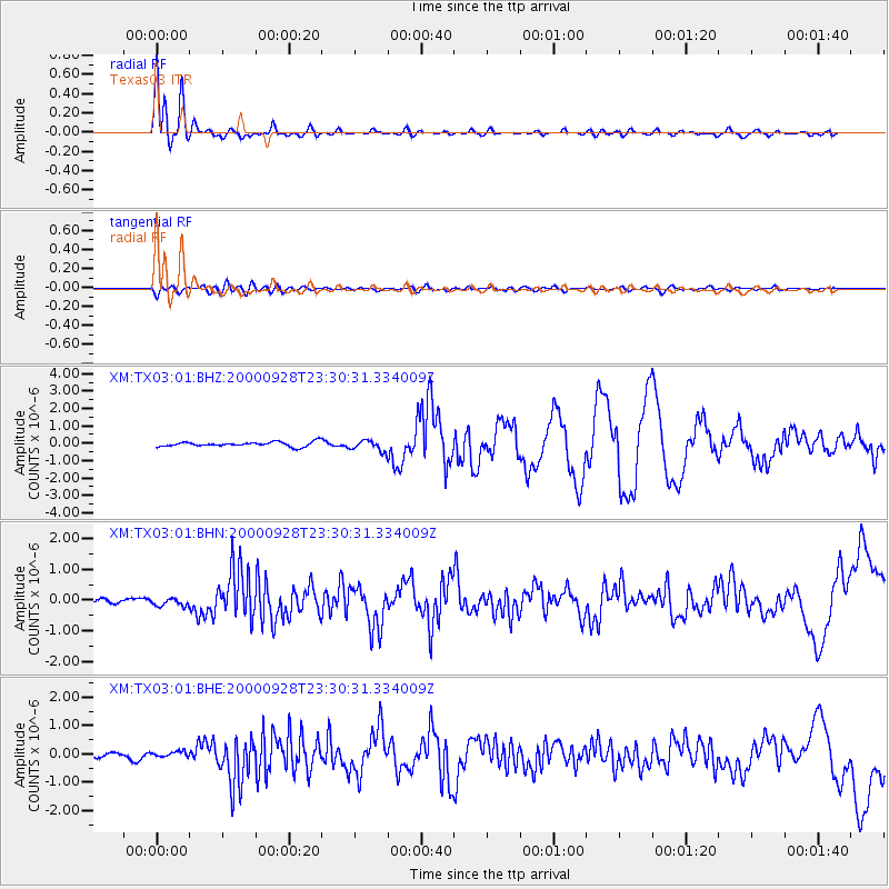
TX03 Texas03 - Earthquake Result Viewer

| Earthquake location: |
Near Coast Of Ecuador |
| Earthquake latitude/longitude: |
-0.2/-80.6 |
| Earthquake time(UTC): |
2000/09/28 (272) 23:23:43 GMT |
| Earthquake Depth: |
23 km |
| Earthquake Magnitude: |
5.8 MB, 6.0 MS, 6.6 MW, 6.4 MW |
| Earthquake Catalog/Contributor: |
WHDF/NEIC |
|
| Network: |
XM Rio Grande Seismic Transect |
| Station: |
TX03 Texas03 |
| Lat/Lon: |
31.62 N/103.32 W |
| Elevation: |
831 m |
|
| Distance: |
38.3 deg |
| Az: |
327.85 deg |
| Baz: |
141.408 deg |
| Ray Param: |
0.07560933 |
| Estimated Moho Depth: |
10.0 km |
| Estimated Crust Vp/Vs: |
1.60 |
| Assumed Crust Vp: |
6.121 km/s |
| Estimated Crust Vs: |
3.825 km/s |
| Estimated Crust Poisson's Ratio: |
0.18 |
|
| Radial Match: |
92.853516 % |
| Radial Bump: |
400 |
| Transverse Match: |
66.589966 % |
| Transverse Bump: |
400 |
| SOD ConfigId: |
16820 |
| Insert Time: |
2010-02-26 17:34:10.228 +0000 |
| GWidth: |
2.5 |
| Max Bumps: |
400 |
| Tol: |
0.001 |
|
Signal To Noise
| Channel | StoN | STA | LTA |
| XM:TX03:01:BHN:20000928T23:30:31.334009Z | 1.5080234 | 1.242191E-7 | 8.237213E-8 |
| XM:TX03:01:BHE:20000928T23:30:31.334009Z | 0.9795595 | 1.0110148E-7 | 1.03211164E-7 |
| XM:TX03:01:BHZ:20000928T23:30:31.334009Z | 2.2733843 | 3.0402225E-7 | 1.3373113E-7 |
| Arrivals |
| Ps | 1.1 SECOND |
| PpPs | 4.0 SECOND |
| PsPs/PpSs | 5.0 SECOND |


