You are here: Home > Network List > XM99 - Rio Grande Seismic Transect Stations List
> Station TX05 Texas05 > Earthquake Result Viewer
TX05 Texas05 - Earthquake Result Viewer

| Earthquake location: |
Southeast Of Honshu, Japan |
| Earthquake latitude/longitude: |
30.5/137.7 |
| Earthquake time(UTC): |
2000/06/09 (161) 22:35:13 GMT |
| Earthquake Depth: |
473 km |
| Earthquake Magnitude: |
5.4 MB, 5.9 MW, 5.8 MW |
| Earthquake Catalog/Contributor: |
WHDF/NEIC |
|
| Network: |
XM Rio Grande Seismic Transect |
| Station: |
TX05 Texas05 |
| Lat/Lon: |
31.88 N/103.61 W |
| Elevation: |
873 m |
|
| Distance: |
95.0 deg |
| Az: |
48.508 deg |
| Baz: |
310.523 deg |
| Ray Param: |
0.040442754 |
| Estimated Moho Depth: |
10.0 km |
| Estimated Crust Vp/Vs: |
1.60 |
| Assumed Crust Vp: |
6.121 km/s |
| Estimated Crust Vs: |
3.825 km/s |
| Estimated Crust Poisson's Ratio: |
0.18 |
|
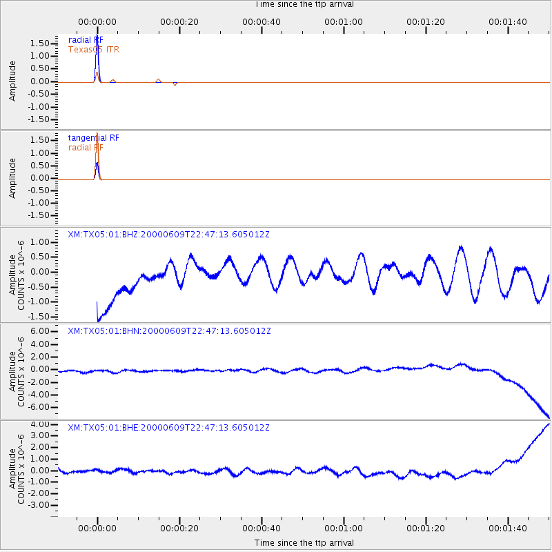
| Radial Match: |
99.89527 % |
| Radial Bump: |
8 |
| Transverse Match: |
99.898735 % |
| Transverse Bump: |
8 |
| SOD ConfigId: |
16820 |
| Insert Time: |
2010-02-26 17:35:04.148 +0000 |
| GWidth: |
2.5 |
| Max Bumps: |
400 |
| Tol: |
0.001 |
|
Signal To Noise
| Channel | StoN | STA | LTA |
| XM:TX05:01:BHN:20000609T22:47:13.605012Z | 0.9865312 | 6.244675E-7 | 6.3299314E-7 |
| XM:TX05:01:BHE:20000609T22:47:13.605012Z | 0.84435517 | 3.398615E-7 | 4.0251012E-7 |
| XM:TX05:01:BHZ:20000609T22:47:13.605012Z | 1.0006384 | 5.511695E-7 | 5.5081784E-7 |
| Arrivals |
| Ps | 1.0 SECOND |
| PpPs | 4.2 SECOND |
| PsPs/PpSs | 5.2 SECOND |


