You are here: Home > Network List > IC - New China Digital Seismograph Network Stations List
> Station HIA Hailar, Neimenggu Autonomous Region, China > Earthquake Result Viewer
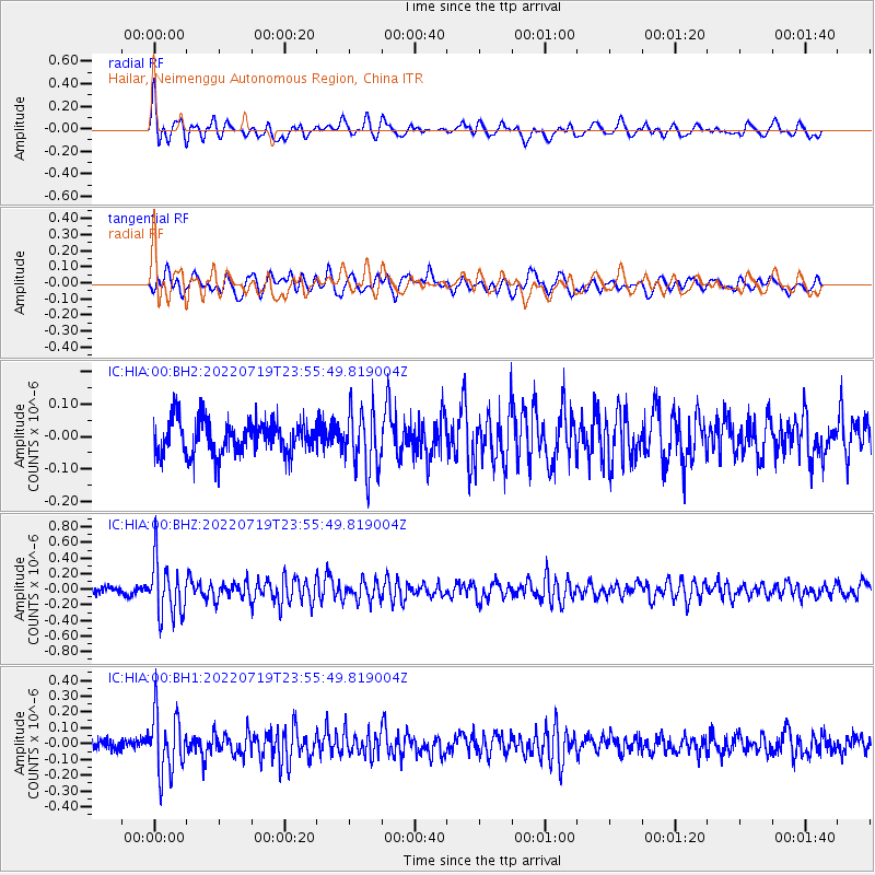
HIA Hailar, Neimenggu Autonomous Region, China - Earthquake Result Viewer
*The percent match for this event was below the threshold and hence no stack was calculated.
| Earthquake location: |
Southern Sumatra, Indonesia |
| Earthquake latitude/longitude: |
-4.2/102.1 |
| Earthquake time(UTC): |
2022/07/19 (200) 23:46:51 GMT |
| Earthquake Depth: |
57 km |
| Earthquake Magnitude: |
5.4 Mww |
| Earthquake Catalog/Contributor: |
NEIC PDE/us |
|
| Network: |
IC New China Digital Seismograph Network |
| Station: |
HIA Hailar, Neimenggu Autonomous Region, China |
| Lat/Lon: |
49.27 N/119.74 E |
| Elevation: |
620 m |
|
| Distance: |
55.4 deg |
| Az: |
13.946 deg |
| Baz: |
201.53 deg |
| Ray Param: |
$rayparam |
*The percent match for this event was below the threshold and hence was not used in the summary stack. |
|
| Radial Match: |
70.87161 % |
| Radial Bump: |
400 |
| Transverse Match: |
51.250225 % |
| Transverse Bump: |
400 |
| SOD ConfigId: |
28208852 |
| Insert Time: |
2022-08-02 23:53:23.260 +0000 |
| GWidth: |
2.5 |
| Max Bumps: |
400 |
| Tol: |
0.001 |
|
Signal To Noise
| Channel | StoN | STA | LTA |
| IC:HIA:00:BHZ:20220719T23:55:49.819004Z | 6.9249454 | 3.5188597E-7 | 5.081426E-8 |
| IC:HIA:00:BH1:20220719T23:55:49.819004Z | 6.020439 | 1.9214997E-7 | 3.191627E-8 |
| IC:HIA:00:BH2:20220719T23:55:49.819004Z | 1.7722996 | 9.36245E-8 | 5.2826564E-8 |
| Arrivals |
| Ps | |
| PpPs | |
| PsPs/PpSs | |


