
AZ50 Arizona50 - Earthquake Result Viewer
| ||||||||||||||||||
| ||||||||||||||||||
| ||||||||||||||||||
|
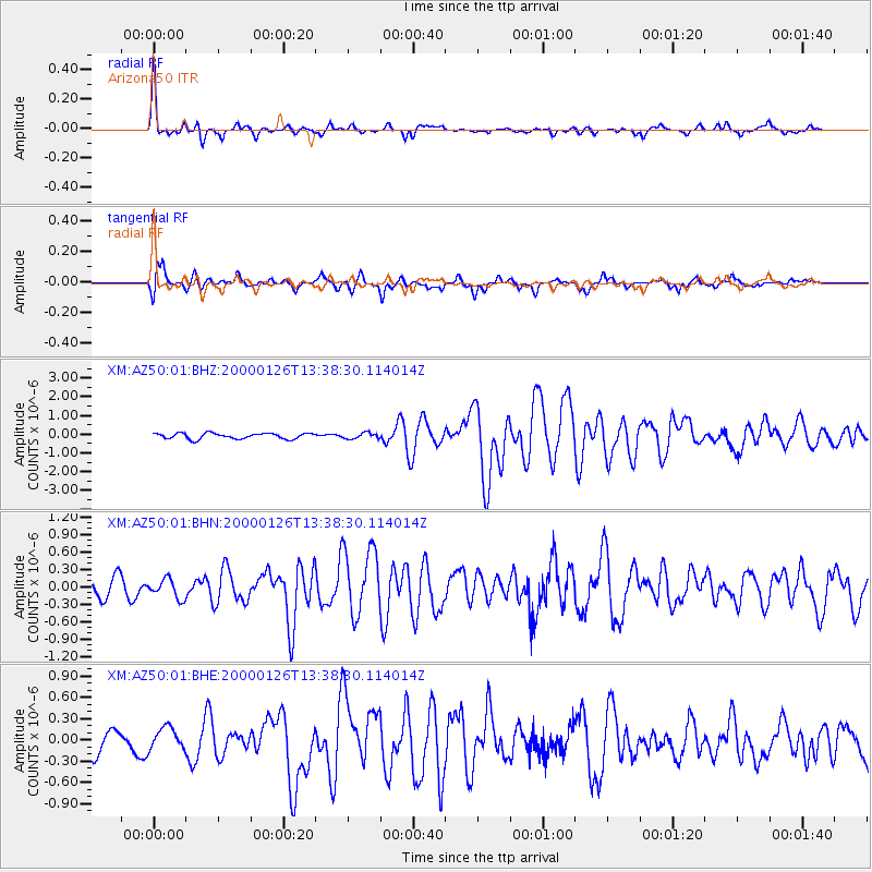
Signal To Noise
| Channel | StoN | STA | LTA |
| XM:AZ50:01:BHN:20000126T13:38:30.114014Z | 1.442337 | 1.6565005E-7 | 1.1484837E-7 |
| XM:AZ50:01:BHE:20000126T13:38:30.114014Z | 1.0568303 | 1.5788467E-7 | 1.4939452E-7 |
| XM:AZ50:01:BHZ:20000126T13:38:30.114014Z | 1.0454932 | 1.5873708E-7 | 1.5182984E-7 |
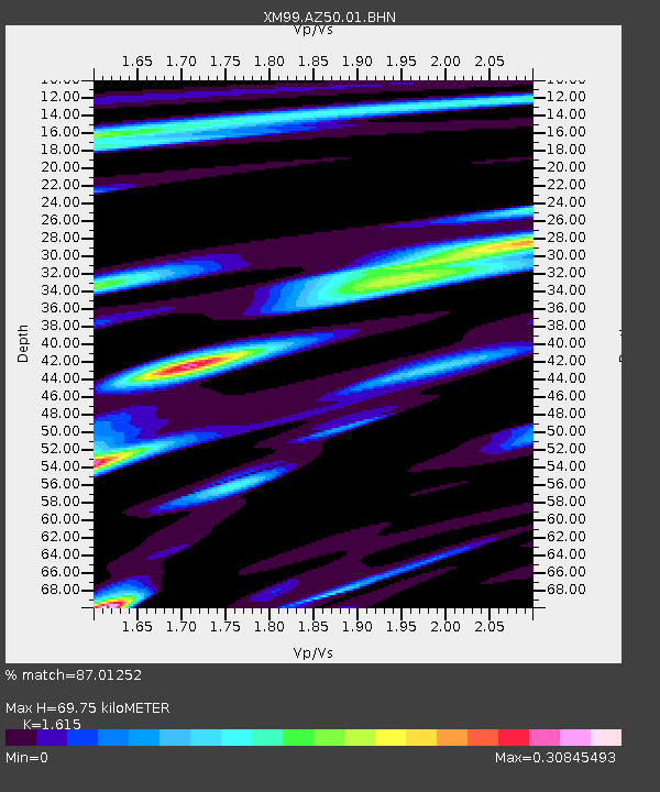
| Arrivals | |
| Ps | 6.8 SECOND |
| PpPs | 27 SECOND |
| PsPs/PpSs | 34 SECOND |

