AZ50 Arizona50 - Earthquake Result Viewer
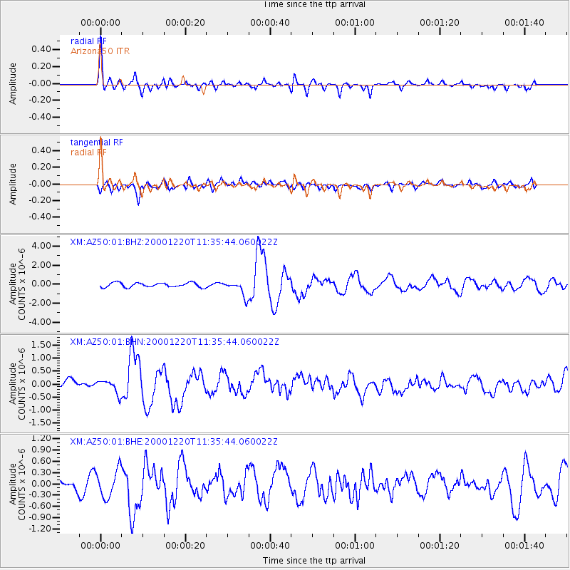
Earthquake location: Off Coast Of Central Chile
Earthquake latitude/longitude: -39.0/-74.7
Earthquake time(UTC): 2000/12/20 (355) 11:23:54 GMT
Earthquake Depth: 11 km
Earthquake Magnitude: 6.1 MB, 6.2 MS, 6.4 MW, 6.0 ME
Earthquake Catalog/Contributor: WHDF/NEIC
Network: XM Rio Grande Seismic Transect
Station: AZ50 Arizona50
Lat/Lon: 36.98 N/109.86 W
Elevation: 1469 m
Distance: 82.3 deg
Az: 332.234 deg
Baz: 153.048 deg
Ray Param: 0.046996713
Estimated Moho Depth: 20.75 km
Estimated Crust Vp/Vs: 1.60
Assumed Crust Vp: 6.476 km/s
Estimated Crust Vs: 4.047 km/s
Estimated Crust Poisson's Ratio: 0.18
Radial Match: 84.60235 %
Radial Bump: 400
Transverse Match: 75.17685 %
Transverse Bump: 400
SOD ConfigId: 16820
Insert Time: 2010-02-26 17:35:49.640 +0000
GWidth: 2.5
Max Bumps: 400
Tol: 0.001

Signal To Noise

ChannelStoNSTALTA
XM:AZ50:01:BHN:20001220T11:35:44.060022Z1.42252.6973225E-71.8961846E-7
XM:AZ50:01:BHE:20001220T11:35:44.060022Z1.86601753.7541267E-72.011839E-7
XM:AZ50:01:BHZ:20001220T11:35:44.060022Z3.58163678.406818E-72.3472002E-7
Arrivals
Ps2.0 SECOND
PpPs8.1 SECOND
PsPs/PpSs10 SECOND