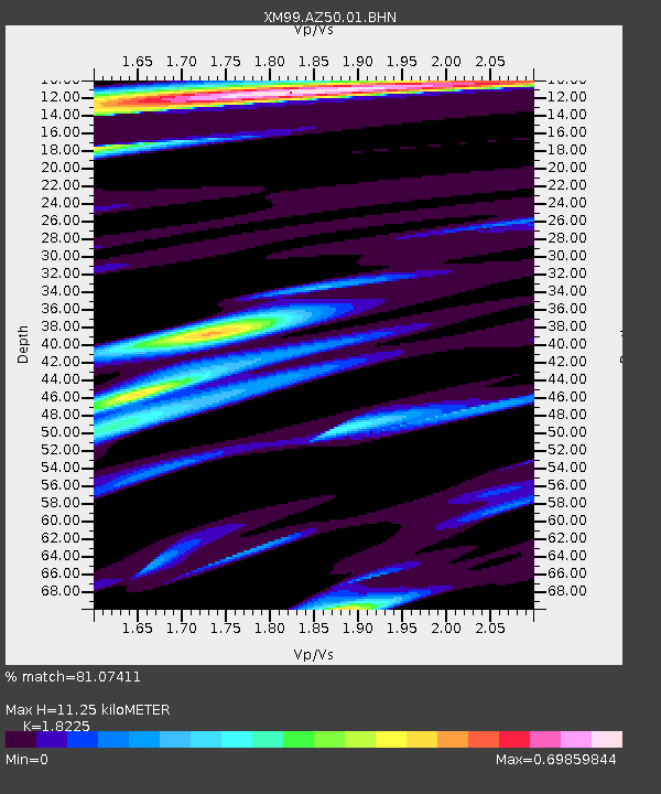
AZ50 Arizona50 - Earthquake Result Viewer
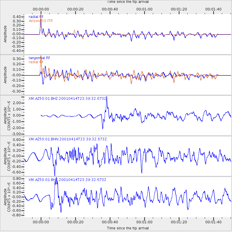
Earthquake location: Southeast Of Honshu, Japan
Earthquake latitude/longitude: 30.1/141.8
Earthquake time(UTC): 2001/04/14 (104) 23:27:26 GMT
Earthquake Depth: 10 km
Earthquake Magnitude: 6.0 MB, 5.8 MS, 6.0 MW, 6.0 ME
Earthquake Catalog/Contributor: WHDF/NEIC
Network: XM Rio Grande Seismic Transect
Station: AZ50 Arizona50
Lat/Lon: 36.98 N/109.86 W
Elevation: 1469 m
Distance: 85.4 deg
Az: 49.681 deg
Baz: 304.394 deg
Ray Param: 0.044786543
Estimated Moho Depth: 11.25 km
Estimated Crust Vp/Vs: 1.82
Assumed Crust Vp: 6.476 km/s
Estimated Crust Vs: 3.553 km/s
Estimated Crust Poisson's Ratio: 0.28
Radial Match: 81.07411 %
Radial Bump: 400
Transverse Match: 56.10475 %
Transverse Bump: 400
SOD ConfigId: 16820
Insert Time: 2010-02-26 17:35:50.768 +0000
GWidth: 2.5
Max Bumps: 400
Tol: 0.001

Signal To Noise

ChannelStoNSTALTA
XM:AZ50:01:BHN:20010414T23:39:32.673Z1.55257261.482573E-79.549138E-8
XM:AZ50:01:BHE:20010414T23:39:32.673Z1.1205081.1295535E-71.0080726E-7
XM:AZ50:01:BHZ:20010414T23:39:32.673Z1.68161891.9098296E-71.13570884E-7
Arrivals
Ps1.5 SECOND
PpPs4.8 SECOND
PsPs/PpSs6.3 SECOND