
AZ50 Arizona50 - Earthquake Result Viewer
| ||||||||||||||||||
| ||||||||||||||||||
| ||||||||||||||||||
|
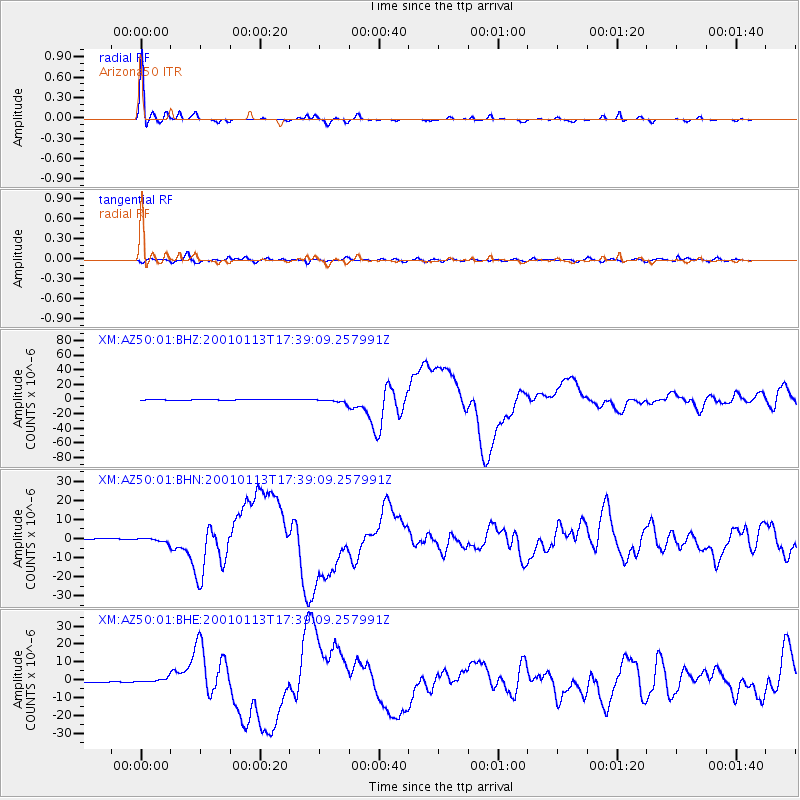
Signal To Noise
| Channel | StoN | STA | LTA |
| XM:AZ50:01:BHN:20010113T17:39:09.257991Z | 4.205139 | 1.1061287E-6 | 2.630421E-7 |
| XM:AZ50:01:BHE:20010113T17:39:09.257991Z | 4.796729 | 1.2715019E-6 | 2.6507686E-7 |
| XM:AZ50:01:BHZ:20010113T17:39:09.257991Z | 6.619 | 2.810636E-6 | 4.246315E-7 |
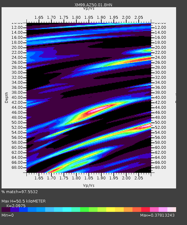
| Arrivals | |
| Ps | 9.2 SECOND |
| PpPs | 23 SECOND |
| PsPs/PpSs | 32 SECOND |

