5110 twist97_5110 - Earthquake Result Viewer
Earthquake location: Northern Peru
Earthquake latitude/longitude: -4.4/-76.7
Earthquake time(UTC): 1997/10/28 (301) 06:15:17 GMT
Earthquake Depth: 112 km
Earthquake Magnitude: 6.6 MB, 6.3 MS, 7.2 UNKNOWN, 6.6 ME
Earthquake Catalog/Contributor: WHDF/NEIC
Network: XK Western Superior Teleseismic Experiment
Station: 5110 twist97_5110
Lat/Lon: 50.02 N/90.59 W
Elevation: 408 m
Distance: 55.5 deg
Az: 349.155 deg
Baz: 163.092 deg
Ray Param: 0.06441508
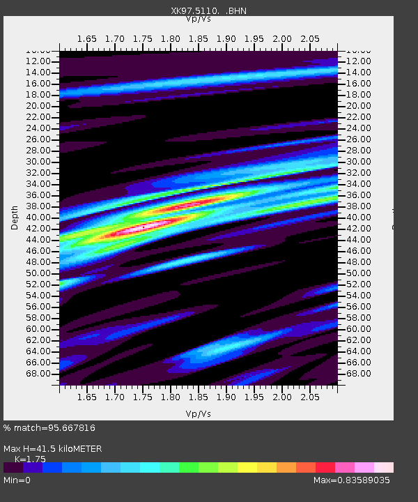
Estimated Moho Depth: 41.5 km
Estimated Crust Vp/Vs: 1.75
Assumed Crust Vp: 6.459 km/s
Estimated Crust Vs: 3.691 km/s
Estimated Crust Poisson's Ratio: 0.26
Radial Match: 95.667816 %
Radial Bump: 358
Transverse Match: 82.66911 %
Transverse Bump: 400
SOD ConfigId: 6273
Insert Time: 2010-03-09 22:54:32.190 +0000
GWidth: 2.5
Max Bumps: 400
Tol: 0.001

Signal To Noise

ChannelStoNSTALTA
XK:5110: :BHN:19971028T06:24:09.932019Z7.6253641.677196E-62.1994963E-7
XK:5110: :BHE:19971028T06:24:09.932019Z2.02862125.899703E-72.908233E-7
XK:5110: :BHZ:19971028T06:24:09.932019Z11.3585983.7049308E-63.2617854E-7
Arrivals
Ps5.1 SECOND
PpPs17 SECOND
PsPs/PpSs22 SECOND