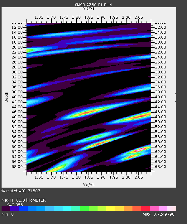
AZ50 Arizona50 - Earthquake Result Viewer
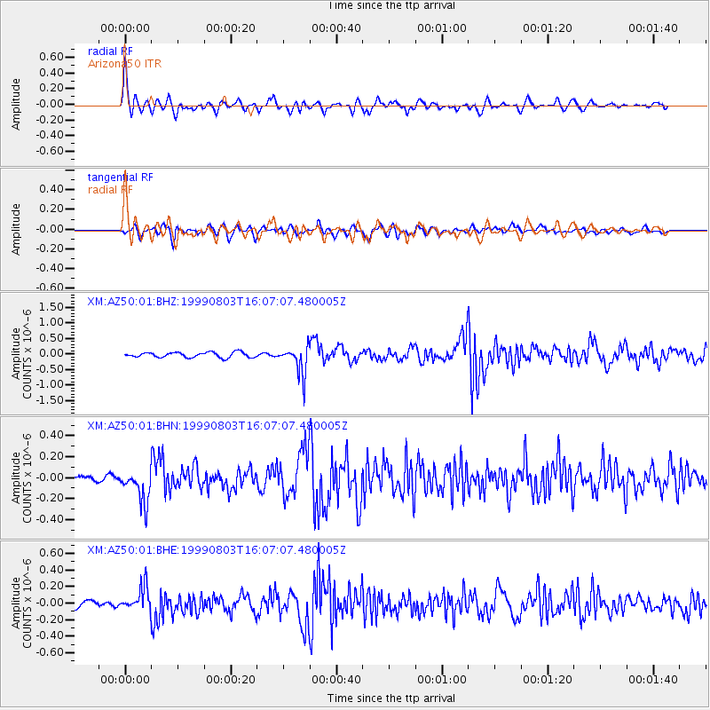
Earthquake location: Near Coast Of Ecuador
Earthquake latitude/longitude: -3.5/-79.2
Earthquake time(UTC): 1999/08/03 (215) 15:58:57 GMT
Earthquake Depth: 88 km
Earthquake Magnitude: 5.7 MB, 5.0 MS, 5.9 MW, 5.9 MW
Earthquake Catalog/Contributor: WHDF/NEIC
Network: XM Rio Grande Seismic Transect
Station: AZ50 Arizona50
Lat/Lon: 36.98 N/109.86 W
Elevation: 1469 m
Distance: 49.3 deg
Az: 327.389 deg
Baz: 137.795 deg
Ray Param: 0.06848608
Estimated Moho Depth: 61.0 km
Estimated Crust Vp/Vs: 2.06
Assumed Crust Vp: 6.476 km/s
Estimated Crust Vs: 3.151 km/s
Estimated Crust Poisson's Ratio: 0.34
Radial Match: 81.71587 %
Radial Bump: 400
Transverse Match: 79.03279 %
Transverse Bump: 400
SOD ConfigId: 27569
Insert Time: 2010-02-26 17:36:02.862 +0000
GWidth: 2.5
Max Bumps: 400
Tol: 0.001

Signal To Noise

ChannelStoNSTALTA
XM:AZ50:01:BHN:19990803T16:07:07.480005Z4.4677751.6438703E-73.679394E-8
XM:AZ50:01:BHE:19990803T16:07:07.480005Z2.6538841.4845271E-75.593791E-8
XM:AZ50:01:BHZ:19990803T16:07:07.480005Z5.6077354.637861E-78.270471E-8
Arrivals
Ps10 SECOND
PpPs27 SECOND
PsPs/PpSs38 SECOND