
AZ50 Arizona50 - Earthquake Result Viewer
| ||||||||||||||||||
| ||||||||||||||||||
| ||||||||||||||||||
|
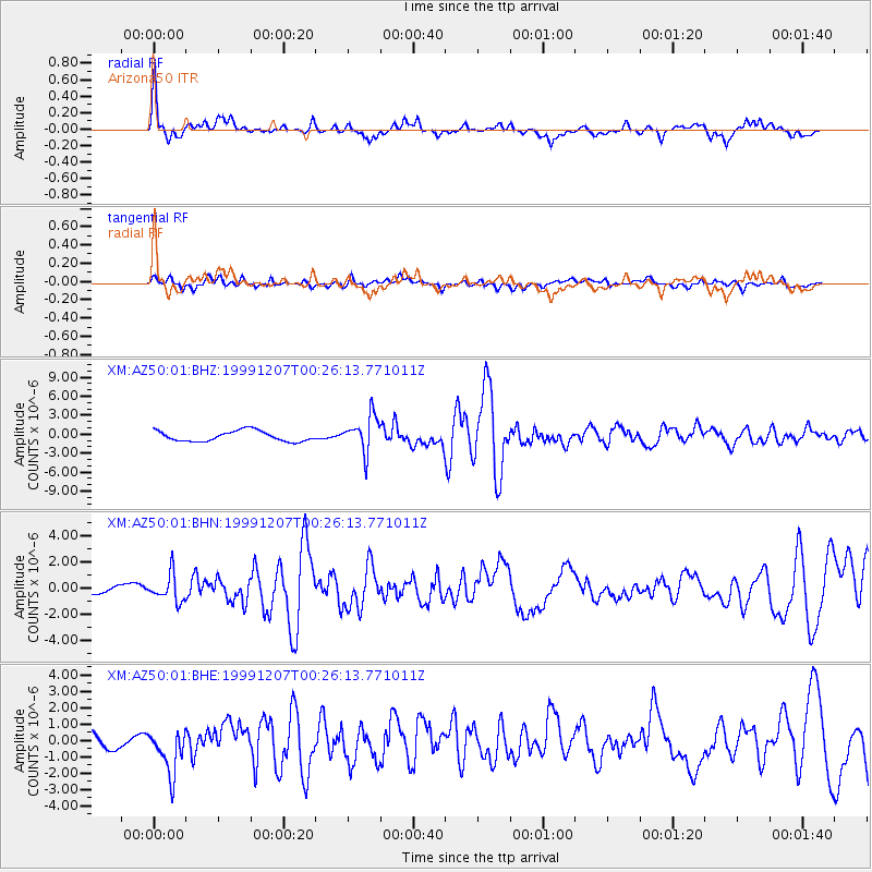
Signal To Noise
| Channel | StoN | STA | LTA |
| XM:AZ50:01:BHN:19991207T00:26:13.771011Z | 3.7724352 | 1.0333608E-6 | 2.7392406E-7 |
| XM:AZ50:01:BHE:19991207T00:26:13.771011Z | 2.893144 | 1.4241483E-6 | 4.922494E-7 |
| XM:AZ50:01:BHZ:19991207T00:26:13.771011Z | 3.5014453 | 2.879399E-6 | 8.2234584E-7 |
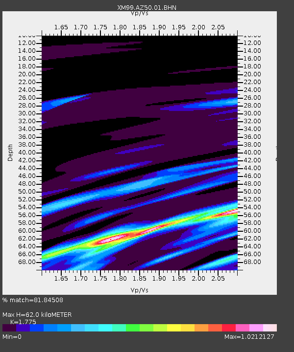
| Arrivals | |
| Ps | 8.0 SECOND |
| PpPs | 25 SECOND |
| PsPs/PpSs | 33 SECOND |

