You are here: Home > Network List > XM99 - Rio Grande Seismic Transect Stations List
> Station NM42 NewMexico42 > Earthquake Result Viewer
NM42 NewMexico42 - Earthquake Result Viewer

| Earthquake location: |
Sea Of Okhotsk |
| Earthquake latitude/longitude: |
46.8/145.4 |
| Earthquake time(UTC): |
2000/07/10 (192) 09:58:18 GMT |
| Earthquake Depth: |
360 km |
| Earthquake Magnitude: |
6.1 MB, 5.9 MW, 5.8 MW |
| Earthquake Catalog/Contributor: |
WHDF/NEIC |
|
| Network: |
XM Rio Grande Seismic Transect |
| Station: |
NM42 NewMexico42 |
| Lat/Lon: |
36.15 N/108.72 W |
| Elevation: |
1794 m |
|
| Distance: |
74.0 deg |
| Az: |
54.076 deg |
| Baz: |
316.607 deg |
| Ray Param: |
0.051558014 |
| Estimated Moho Depth: |
10.0 km |
| Estimated Crust Vp/Vs: |
1.60 |
| Assumed Crust Vp: |
6.476 km/s |
| Estimated Crust Vs: |
4.047 km/s |
| Estimated Crust Poisson's Ratio: |
0.18 |
|
| Radial Match: |
99.99944 % |
| Radial Bump: |
2 |
| Transverse Match: |
99.95867 % |
| Transverse Bump: |
6 |
| SOD ConfigId: |
16820 |
| Insert Time: |
2010-02-26 17:36:23.008 +0000 |
| GWidth: |
2.5 |
| Max Bumps: |
400 |
| Tol: |
0.001 |
|
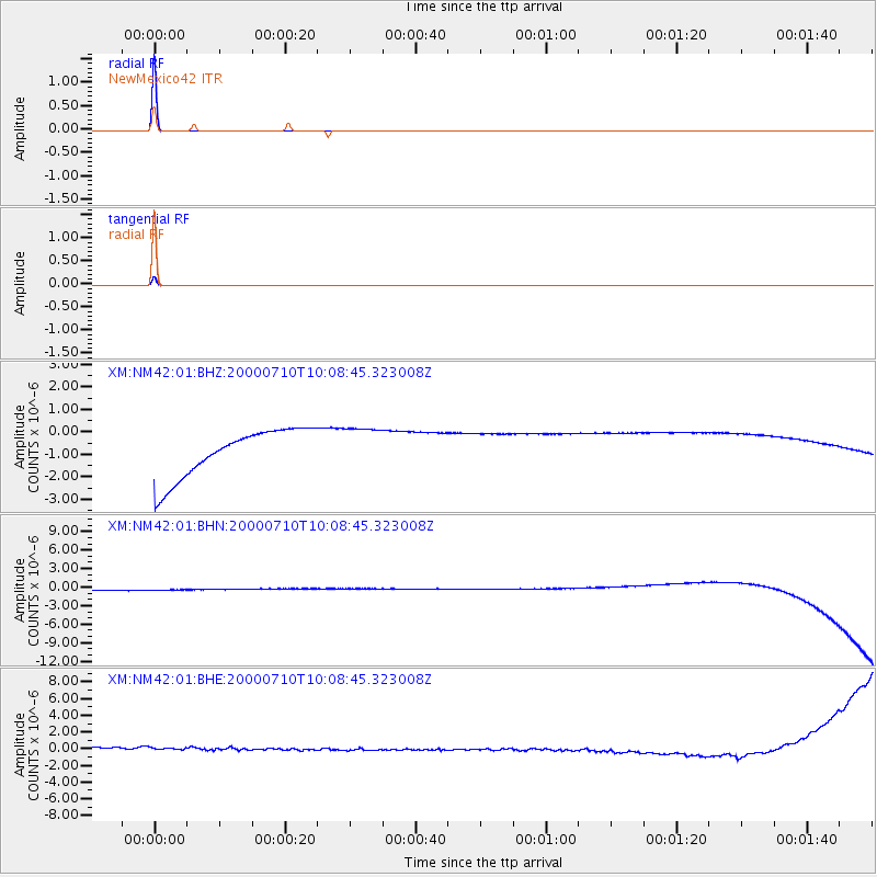
Signal To Noise
| Channel | StoN | STA | LTA |
| XM:NM42:01:BHN:20000710T10:08:45.323008Z | 0.9187044 | 9.167795E-7 | 9.979049E-7 |
| XM:NM42:01:BHE:20000710T10:08:45.323008Z | 0.8883136 | 7.3211254E-7 | 8.2416E-7 |
| XM:NM42:01:BHZ:20000710T10:08:45.323008Z | 0.91463286 | 9.82629E-7 | 1.0743425E-6 |
| Arrivals |
| Ps | 1.0 SECOND |
| PpPs | 3.9 SECOND |
| PsPs/PpSs | 4.8 SECOND |


