NM42 NewMexico42 - Earthquake Result Viewer
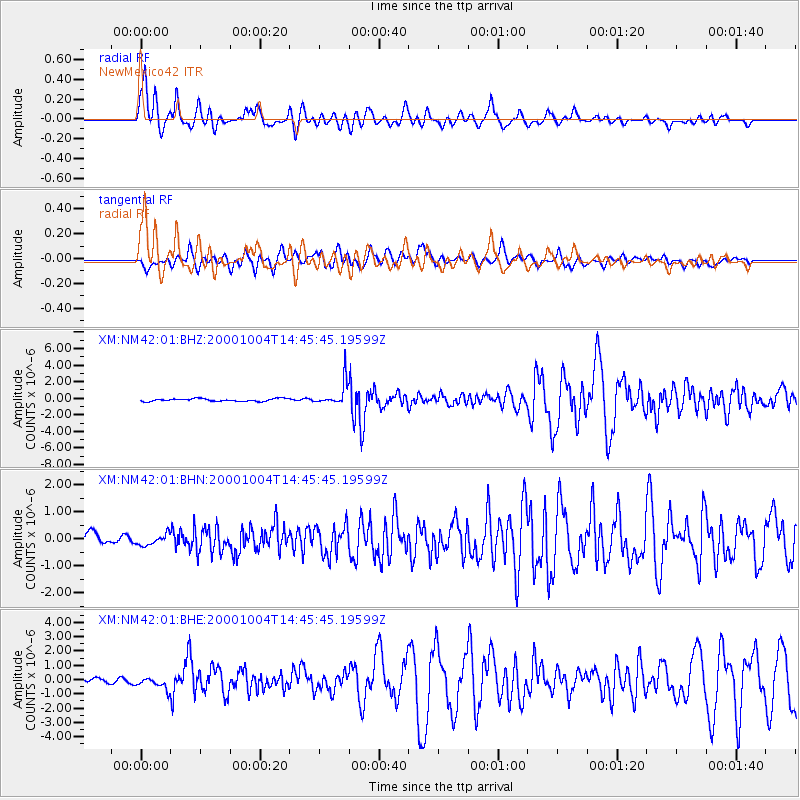
Earthquake location: Windward Islands
Earthquake latitude/longitude: 11.1/-62.6
Earthquake time(UTC): 2000/10/04 (278) 14:37:44 GMT
Earthquake Depth: 110 km
Earthquake Magnitude: 5.6 MB, 5.4 MS, 6.1 MW, 5.9 MD
Earthquake Catalog/Contributor: WHDF/NEIC
Network: XM Rio Grande Seismic Transect
Station: NM42 NewMexico42
Lat/Lon: 36.15 N/108.72 W
Elevation: 1794 m
Distance: 48.5 deg
Az: 308.775 deg
Baz: 109.027 deg
Ray Param: 0.06894789
Estimated Moho Depth: 13.5 km
Estimated Crust Vp/Vs: 2.09
Assumed Crust Vp: 6.476 km/s
Estimated Crust Vs: 3.095 km/s
Estimated Crust Poisson's Ratio: 0.35
Radial Match: 95.73519 %
Radial Bump: 400
Transverse Match: 89.560074 %
Transverse Bump: 400
SOD ConfigId: 16820
Insert Time: 2010-02-26 17:36:28.871 +0000
GWidth: 2.5
Max Bumps: 400
Tol: 0.001

Signal To Noise

ChannelStoNSTALTA
XM:NM42:01:BHN:20001004T14:45:45.19599Z0.98705852.0724754E-72.099648E-7
XM:NM42:01:BHE:20001004T14:45:45.19599Z2.64812734.154851E-71.568977E-7
XM:NM42:01:BHZ:20001004T14:45:45.19599Z9.0981751.4339229E-61.5760556E-7
Arrivals
Ps2.4 SECOND
PpPs6.1 SECOND
PsPs/PpSs8.5 SECOND