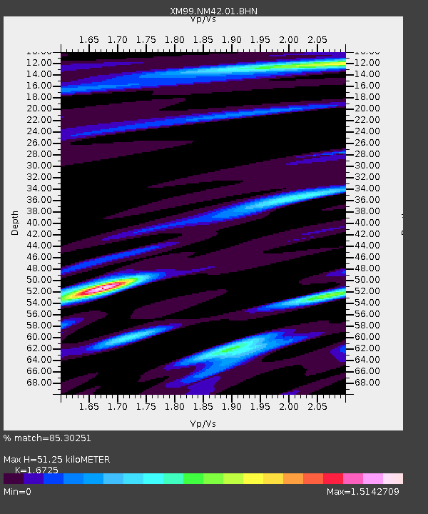
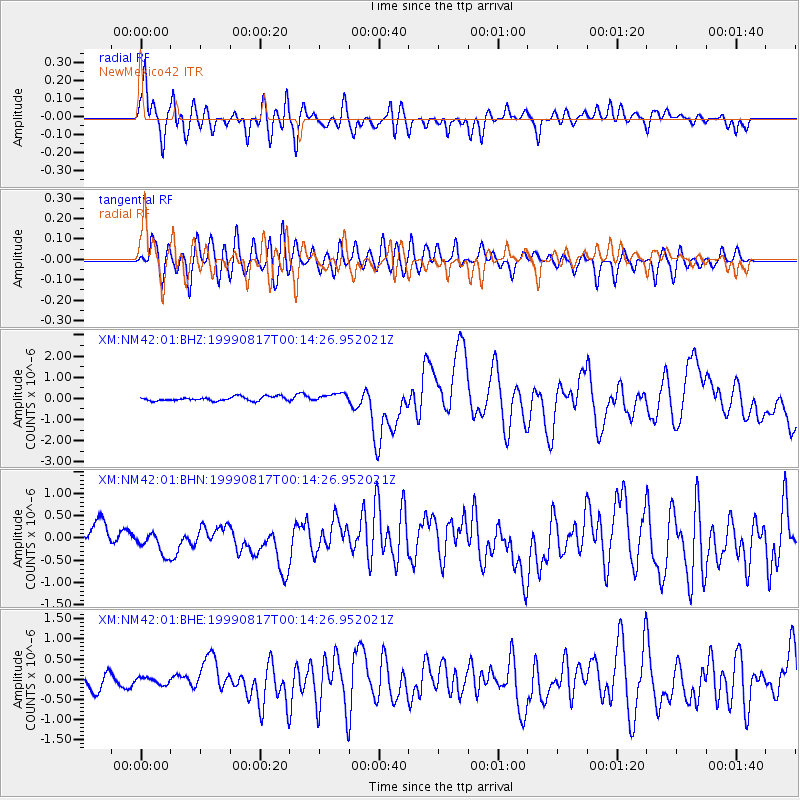
NM42 NewMexico42 - Earthquake Result Viewer

Earthquake location: Turkey
Earthquake latitude/longitude: 40.7/29.9
Earthquake time(UTC): 1999/08/17 (229) 00:01:39 GMT
Earthquake Depth: 17 km
Earthquake Magnitude: 6.3 MB, 7.8 MS, 7.7 ME, 7.6 MW
Earthquake Catalog/Contributor: WHDF/NEIC
Network: XM Rio Grande Seismic Transect
Station: NM42 NewMexico42
Lat/Lon: 36.15 N/108.72 W
Elevation: 1794 m
Distance: 94.5 deg
Az: 327.511 deg
Baz: 30.279 deg
Ray Param: 0.04101463
Estimated Moho Depth: 51.25 km
Estimated Crust Vp/Vs: 1.67
Assumed Crust Vp: 6.476 km/s
Estimated Crust Vs: 3.872 km/s
Estimated Crust Poisson's Ratio: 0.22
Radial Match: 85.30251 %
Radial Bump: 400
Transverse Match: 75.925964 %
Transverse Bump: 400
SOD ConfigId: 27569
Insert Time: 2010-02-26 17:36:36.651 +0000
GWidth: 2.5
Max Bumps: 400
Tol: 0.001

Signal To Noise

ChannelStoNSTALTA
XM:NM42:01:BHN:19990817T00:14:26.952021Z0.42698022.1023642E-74.923798E-7
XM:NM42:01:BHE:19990817T00:14:26.952021Z0.437070078.288269E-81.896325E-7
XM:NM42:01:BHZ:19990817T00:14:26.952021Z2.02199341.9402783E-79.595869E-8
Arrivals
Ps5.4 SECOND
PpPs21 SECOND
PsPs/PpSs26 SECOND