NM43 NewMexico43 - Earthquake Result Viewer
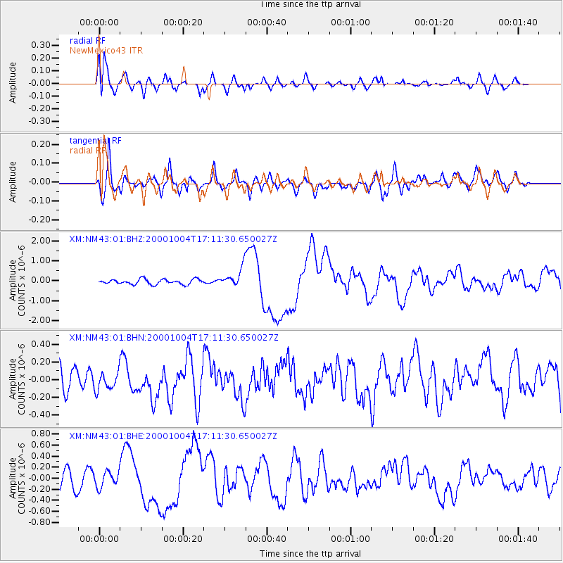
Earthquake location: Vanuatu Islands
Earthquake latitude/longitude: -15.4/166.9
Earthquake time(UTC): 2000/10/04 (278) 16:58:44 GMT
Earthquake Depth: 23 km
Earthquake Magnitude: 6.1 MB, 6.9 MS, 6.8 MW, 6.5 ME
Earthquake Catalog/Contributor: WHDF/NEIC
Network: XM Rio Grande Seismic Transect
Station: NM43 NewMexico43
Lat/Lon: 36.25 N/108.89 W
Elevation: 1991 m
Distance: 94.4 deg
Az: 53.764 deg
Baz: 254.231 deg
Ray Param: 0.041043997
Estimated Moho Depth: 16.25 km
Estimated Crust Vp/Vs: 1.62
Assumed Crust Vp: 6.476 km/s
Estimated Crust Vs: 4.01 km/s
Estimated Crust Poisson's Ratio: 0.19
Radial Match: 88.473206 %
Radial Bump: 400
Transverse Match: 69.76355 %
Transverse Bump: 400
SOD ConfigId: 16820
Insert Time: 2010-02-26 17:36:47.986 +0000
GWidth: 2.5
Max Bumps: 400
Tol: 0.001

Signal To Noise

ChannelStoNSTALTA
XM:NM43:01:BHN:20001004T17:11:30.650027Z0.77800721.1443628E-71.4708898E-7
XM:NM43:01:BHE:20001004T17:11:30.650027Z1.00444221.4341651E-71.4278224E-7
XM:NM43:01:BHZ:20001004T17:11:30.650027Z4.02953625.046843E-71.2524625E-7
Arrivals
Ps1.6 SECOND
PpPs6.4 SECOND
PsPs/PpSs8.0 SECOND