
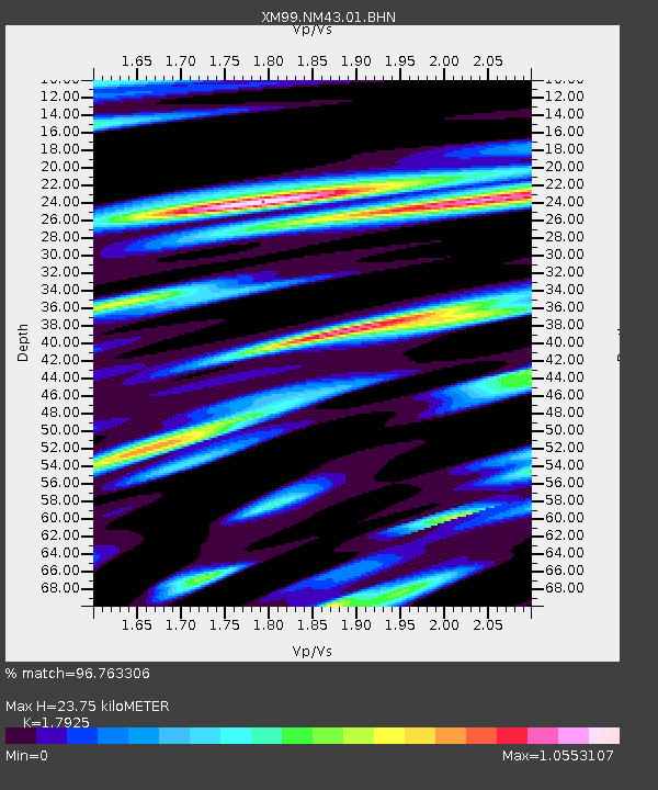
NM43 NewMexico43 - Earthquake Result Viewer
| ||||||||||||||||||
| ||||||||||||||||||
| ||||||||||||||||||
|
Signal To Noise
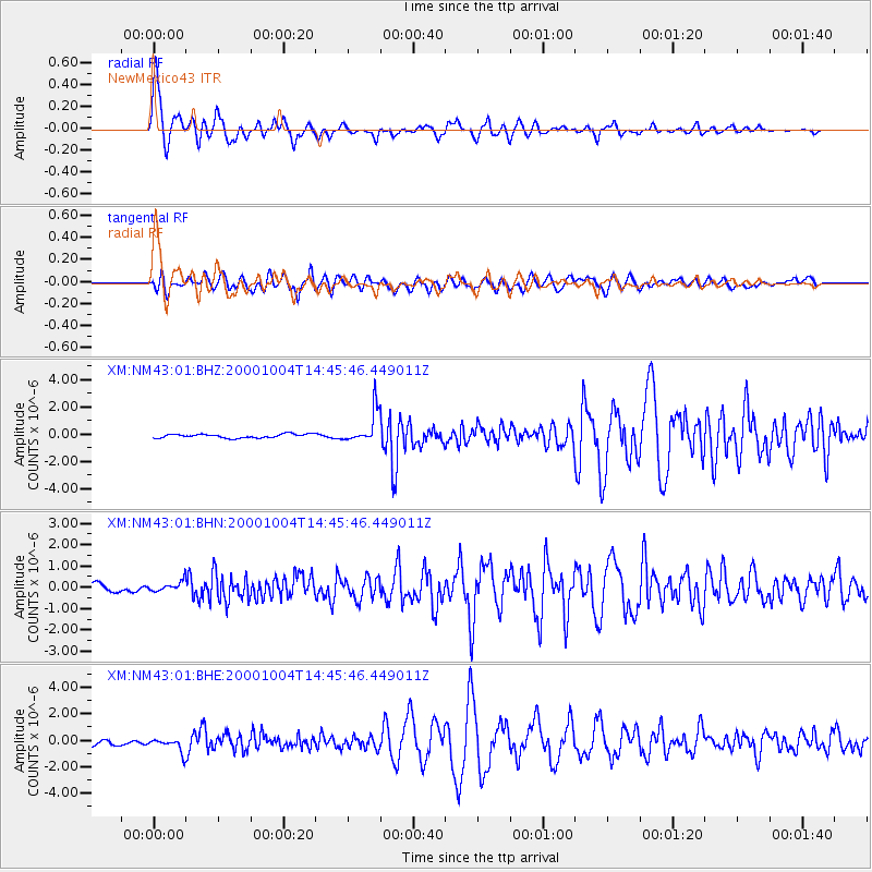
| Channel | StoN | STA | LTA |
| XM:NM43:01:BHN:20001004T14:45:46.449011Z | 1.2980803 | 2.4587246E-7 | 1.8941235E-7 |
| XM:NM43:01:BHE:20001004T14:45:46.449011Z | 2.815104 | 5.485499E-7 | 1.9485955E-7 |
| XM:NM43:01:BHZ:20001004T14:45:46.449011Z | 8.42438 | 1.1902849E-6 | 1.4129051E-7 |
| Arrivals | |
| Ps | 3.1 SECOND |
| PpPs | 9.7 SECOND |
| PsPs/PpSs | 13 SECOND |

