
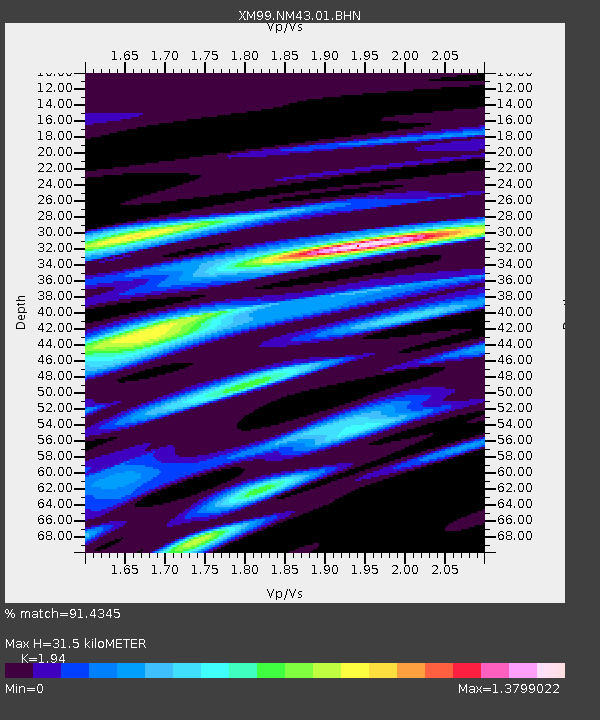
NM43 NewMexico43 - Earthquake Result Viewer
| ||||||||||||||||||
| ||||||||||||||||||
| ||||||||||||||||||
|
Signal To Noise
| Channel | StoN | STA | LTA |
| XM:NM43:01:BHN:19991207T00:26:22.84999Z | 2.6804826 | 2.014515E-6 | 7.5154935E-7 |
| XM:NM43:01:BHE:19991207T00:26:22.84999Z | 3.1127186 | 1.5395824E-6 | 4.946102E-7 |
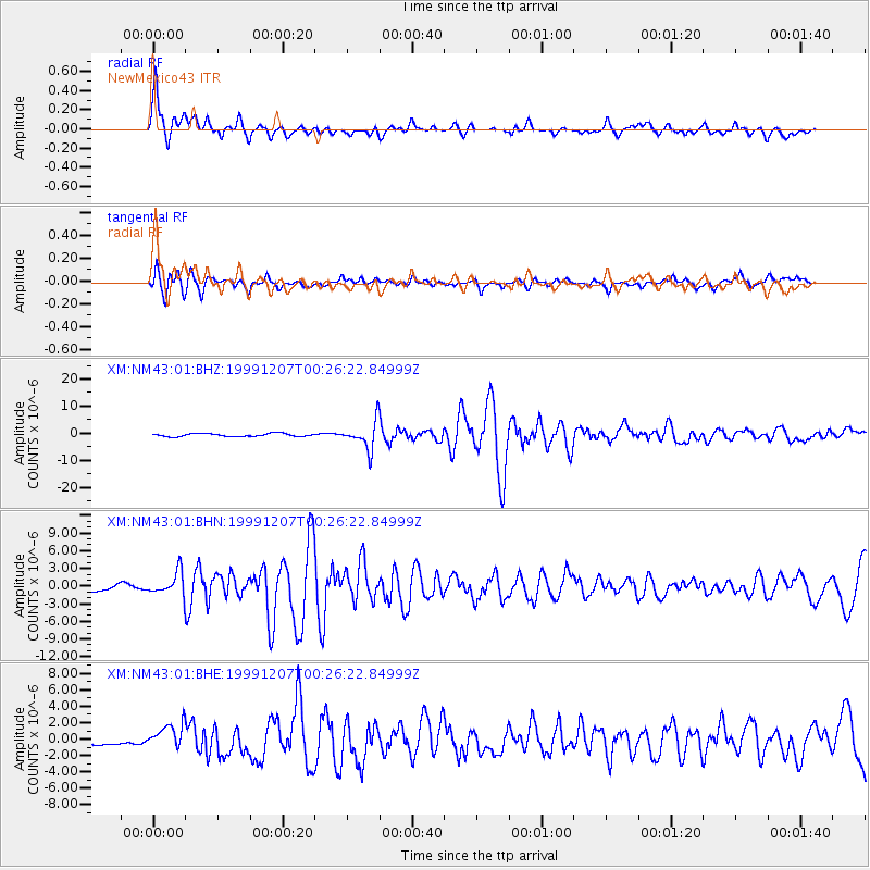
| XM:NM43:01:BHZ:19991207T00:26:22.84999Z | 9.478748 | 5.111935E-6 | 5.393049E-7 |
| Arrivals | |
| Ps | 4.9 SECOND |
| PpPs | 13 SECOND |
| PsPs/PpSs | 18 SECOND |

