NM43 NewMexico43 - Earthquake Result Viewer
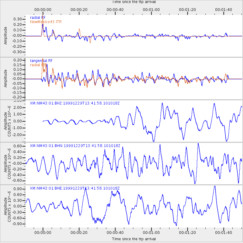
Earthquake location: Santa Cruz Islands
Earthquake latitude/longitude: -10.9/165.4
Earthquake time(UTC): 1999/12/29 (363) 13:29:19 GMT
Earthquake Depth: 33 km
Earthquake Magnitude: 5.6 MB, 6.8 MS, 6.8 MW, 6.3 MW
Earthquake Catalog/Contributor: WHDF/NEIC
Network: XM Rio Grande Seismic Transect
Station: NM43 NewMexico43
Lat/Lon: 36.25 N/108.89 W
Elevation: 1991 m
Distance: 93.0 deg
Az: 53.823 deg
Baz: 258.794 deg
Ray Param: 0.041346118
Estimated Moho Depth: 12.75 km
Estimated Crust Vp/Vs: 1.88
Assumed Crust Vp: 6.476 km/s
Estimated Crust Vs: 3.454 km/s
Estimated Crust Poisson's Ratio: 0.30
Radial Match: 85.9729 %
Radial Bump: 400
Transverse Match: 64.118645 %
Transverse Bump: 400
SOD ConfigId: 27569
Insert Time: 2010-02-26 17:36:58.029 +0000
GWidth: 2.5
Max Bumps: 400
Tol: 0.001

Signal To Noise

ChannelStoNSTALTA
XM:NM43:01:BHN:19991229T13:41:58.101018Z2.95289972.7886597E-79.443801E-8
XM:NM43:01:BHE:19991229T13:41:58.101018Z0.61991081.254101E-72.0230347E-7
XM:NM43:01:BHZ:19991229T13:41:58.101018Z0.725378931.3635956E-71.879839E-7
Arrivals
Ps1.8 SECOND
PpPs5.6 SECOND
PsPs/PpSs7.3 SECOND