
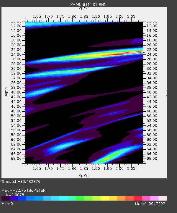
NM44 NewMexico44 - Earthquake Result Viewer
| ||||||||||||||||||
| ||||||||||||||||||
| ||||||||||||||||||
|
Signal To Noise
| Channel | StoN | STA | LTA |
| XM:NM44:01:BHN:20001005T13:48:15.422014Z | 1.5072341 | 2.2526189E-7 | 1.4945383E-7 |
| XM:NM44:01:BHE:20001005T13:48:15.422014Z | 1.0348369 | 2.1668639E-7 | 2.0939183E-7 |
| XM:NM44:01:BHZ:20001005T13:48:15.422014Z | 0.9186197 | 2.0155893E-7 | 2.1941499E-7 |
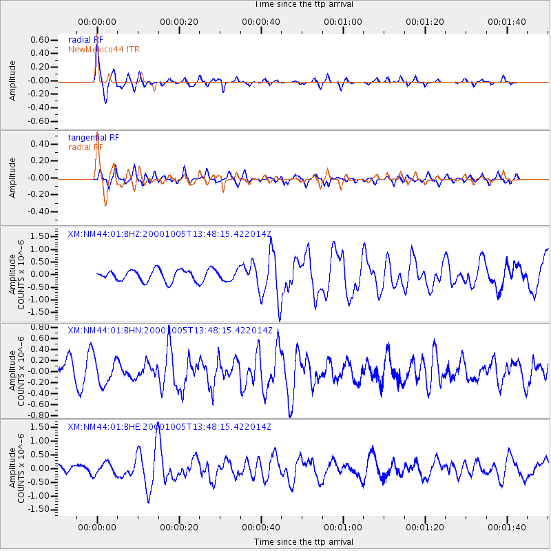
| Arrivals | |
| Ps | 4.0 SECOND |
| PpPs | 10 SECOND |
| PsPs/PpSs | 14 SECOND |

