NM44 NewMexico44 - Earthquake Result Viewer
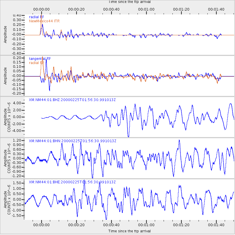
Earthquake location: Vanuatu Islands Region
Earthquake latitude/longitude: -19.5/173.8
Earthquake time(UTC): 2000/02/25 (056) 01:43:58 GMT
Earthquake Depth: 33 km
Earthquake Magnitude: 6.1 MB, 7.1 MS, 7.1 MW, 7.0 MW
Earthquake Catalog/Contributor: WHDF/NEIC
Network: XM Rio Grande Seismic Transect
Station: NM44 NewMexico44
Lat/Lon: 36.42 N/108.96 W
Elevation: 1921 m
Distance: 91.6 deg
Az: 51.898 deg
Baz: 246.955 deg
Ray Param: 0.041574467
Estimated Moho Depth: 56.0 km
Estimated Crust Vp/Vs: 1.78
Assumed Crust Vp: 6.476 km/s
Estimated Crust Vs: 3.633 km/s
Estimated Crust Poisson's Ratio: 0.27
Radial Match: 89.27558 %
Radial Bump: 400
Transverse Match: 78.62771 %
Transverse Bump: 400
SOD ConfigId: 27569
Insert Time: 2010-02-26 17:37:03.649 +0000
GWidth: 2.5
Max Bumps: 400
Tol: 0.001

Signal To Noise

ChannelStoNSTALTA
XM:NM44:01:BHN:20000225T01:56:30.991013Z1.09222251.509713E-71.3822395E-7
XM:NM44:01:BHE:20000225T01:56:30.991013Z1.33047662.4561578E-71.8460737E-7
XM:NM44:01:BHZ:20000225T01:56:30.991013Z1.30708664.515313E-73.4544865E-7
Arrivals
Ps6.9 SECOND
PpPs24 SECOND
PsPs/PpSs30 SECOND