
NM44 NewMexico44 - Earthquake Result Viewer
| ||||||||||||||||||
| ||||||||||||||||||
| ||||||||||||||||||
|
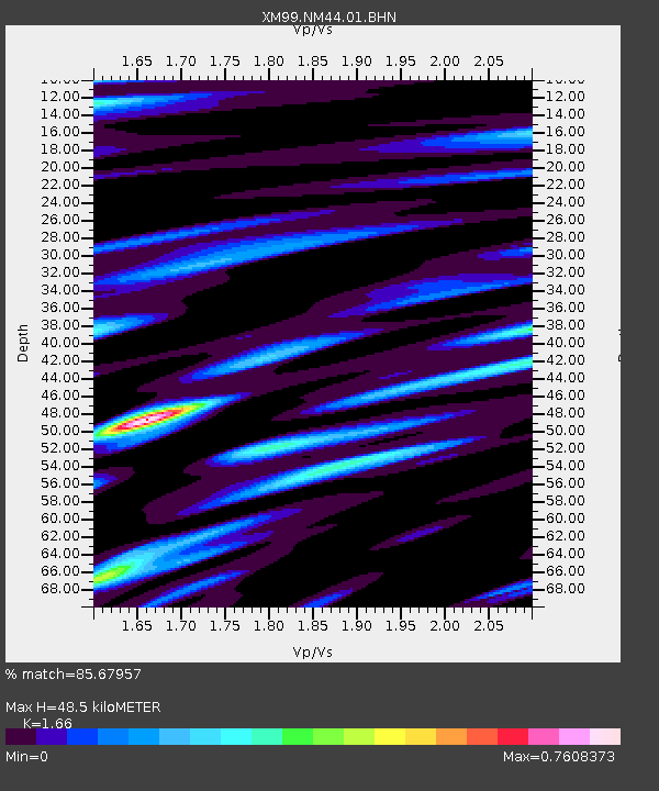
Signal To Noise
| Channel | StoN | STA | LTA |
| XM:NM44:01:BHN:20000126T13:38:32.041016Z | 0.75820506 | 1.297607E-7 | 1.7114196E-7 |
| XM:NM44:01:BHE:20000126T13:38:32.041016Z | 0.7236127 | 1.6182877E-7 | 2.2364001E-7 |
| XM:NM44:01:BHZ:20000126T13:38:32.041016Z | 1.0323625 | 1.8242659E-7 | 1.7670787E-7 |
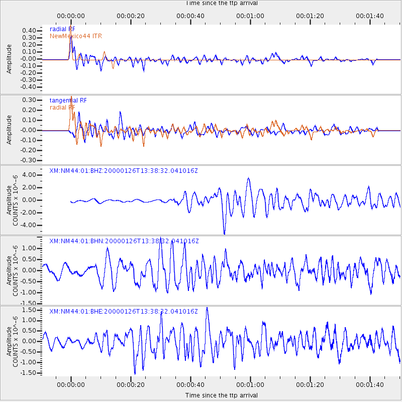
| Arrivals | |
| Ps | 5.1 SECOND |
| PpPs | 19 SECOND |
| PsPs/PpSs | 24 SECOND |

