NM44 NewMexico44 - Earthquake Result Viewer
Earthquake location: South Of Panama
Earthquake latitude/longitude: 6.0/-82.7
Earthquake time(UTC): 2000/12/12 (347) 05:26:45 GMT
Earthquake Depth: 10 km
Earthquake Magnitude: 5.8 MB, 5.7 MS, 6.3 ME, 6.1 MW
Earthquake Catalog/Contributor: WHDF/NEIC
Network: XM Rio Grande Seismic Transect
Station: NM44 NewMexico44
Lat/Lon: 36.42 N/108.96 W
Elevation: 1921 m
Distance: 38.7 deg
Az: 325.139 deg
Baz: 135.185 deg
Ray Param: 0.07543091
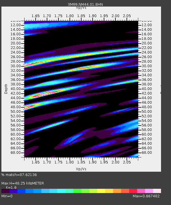
Estimated Moho Depth: 48.25 km
Estimated Crust Vp/Vs: 1.60
Assumed Crust Vp: 6.476 km/s
Estimated Crust Vs: 4.047 km/s
Estimated Crust Poisson's Ratio: 0.18
Radial Match: 87.62136 %
Radial Bump: 372
Transverse Match: 70.40249 %
Transverse Bump: 400
SOD ConfigId: 16820
Insert Time: 2010-02-26 17:37:06.944 +0000
GWidth: 2.5
Max Bumps: 400
Tol: 0.001

Signal To Noise

ChannelStoNSTALTA
XM:NM44:01:BHN:20001212T05:33:38.778013Z0.404075561.11804326E-72.7669162E-7
XM:NM44:01:BHE:20001212T05:33:38.778013Z2.99942163.482835E-71.1611688E-7
XM:NM44:01:BHZ:20001212T05:33:38.778013Z0.57406321.5934815E-72.7757946E-7
Arrivals
Ps4.9 SECOND
PpPs18 SECOND
PsPs/PpSs23 SECOND