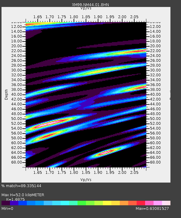
NM44 NewMexico44 - Earthquake Result Viewer
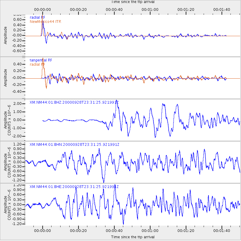
Earthquake location: Near Coast Of Ecuador
Earthquake latitude/longitude: -0.2/-80.6
Earthquake time(UTC): 2000/09/28 (272) 23:23:43 GMT
Earthquake Depth: 23 km
Earthquake Magnitude: 5.8 MB, 6.0 MS, 6.6 MW, 6.4 MW
Earthquake Catalog/Contributor: WHDF/NEIC
Network: XM Rio Grande Seismic Transect
Station: NM44 NewMexico44
Lat/Lon: 36.42 N/108.96 W
Elevation: 1921 m
Distance: 45.0 deg
Az: 327.155 deg
Baz: 137.744 deg
Ray Param: 0.071549274
Estimated Moho Depth: 52.0 km
Estimated Crust Vp/Vs: 1.69
Assumed Crust Vp: 6.476 km/s
Estimated Crust Vs: 3.838 km/s
Estimated Crust Poisson's Ratio: 0.23
Radial Match: 89.335144 %
Radial Bump: 400
Transverse Match: 78.36773 %
Transverse Bump: 400
SOD ConfigId: 16820
Insert Time: 2010-02-26 17:37:12.194 +0000
GWidth: 2.5
Max Bumps: 400
Tol: 0.001

Signal To Noise

ChannelStoNSTALTA
XM:NM44:01:BHN:20000928T23:31:25.921991Z2.52657991.513903E-75.991906E-8
XM:NM44:01:BHE:20000928T23:31:25.921991Z0.96666361.01455015E-71.049538E-7
XM:NM44:01:BHZ:20000928T23:31:25.921991Z2.36549471.668316E-77.052715E-8
Arrivals
Ps5.9 SECOND
PpPs20 SECOND
PsPs/PpSs26 SECOND