NM44 NewMexico44 - Earthquake Result Viewer
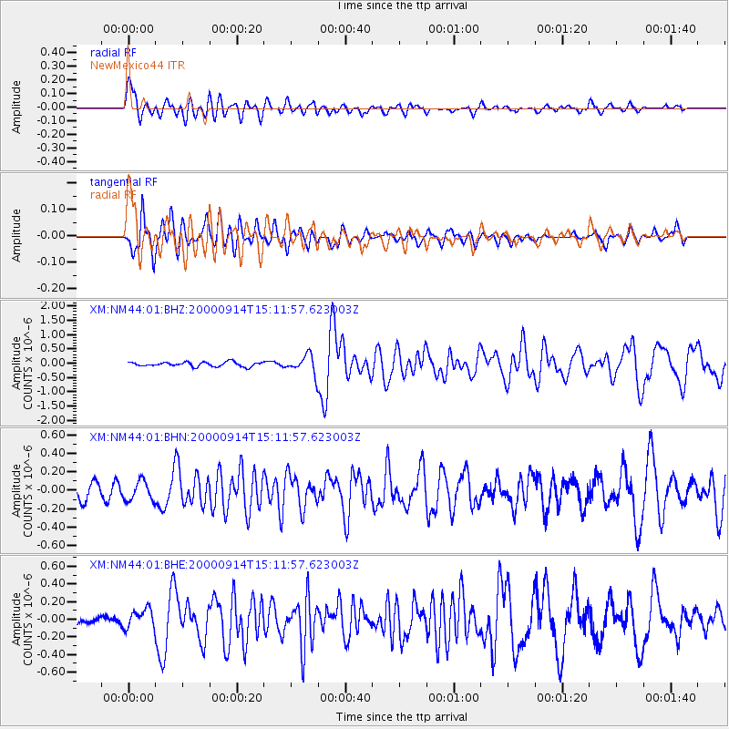
Earthquake location: Fiji Islands
Earthquake latitude/longitude: -15.7/179.8
Earthquake time(UTC): 2000/09/14 (258) 14:59:57 GMT
Earthquake Depth: 33 km
Earthquake Magnitude: 5.7 MB, 6.2 MS, 6.3 MW, 6.2 MW
Earthquake Catalog/Contributor: WHDF/NEIC
Network: XM Rio Grande Seismic Transect
Station: NM44 NewMexico44
Lat/Lon: 36.42 N/108.96 W
Elevation: 1921 m
Distance: 84.8 deg
Az: 50.073 deg
Baz: 246.285 deg
Ray Param: 0.045169514
Estimated Moho Depth: 63.0 km
Estimated Crust Vp/Vs: 1.69
Assumed Crust Vp: 6.476 km/s
Estimated Crust Vs: 3.832 km/s
Estimated Crust Poisson's Ratio: 0.23
Radial Match: 86.193794 %
Radial Bump: 400
Transverse Match: 73.93998 %
Transverse Bump: 400
SOD ConfigId: 16820
Insert Time: 2010-02-26 17:37:14.515 +0000
GWidth: 2.5
Max Bumps: 400
Tol: 0.001

Signal To Noise

ChannelStoNSTALTA
XM:NM44:01:BHN:20000914T15:11:57.623003Z1.15748111.0709837E-79.25271E-8
XM:NM44:01:BHE:20000914T15:11:57.623003Z1.49547531.1144537E-77.452171E-8
XM:NM44:01:BHZ:20000914T15:11:57.623003Z4.27898553.280043E-77.6654686E-8
Arrivals
Ps6.9 SECOND
PpPs25 SECOND
PsPs/PpSs32 SECOND