
NM44 NewMexico44 - Earthquake Result Viewer
| ||||||||||||||||||
| ||||||||||||||||||
| ||||||||||||||||||
|
Signal To Noise
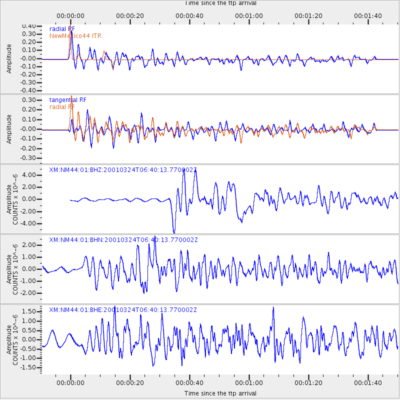
| Channel | StoN | STA | LTA |
| XM:NM44:01:BHN:20010324T06:40:13.770002Z | 1.1497035 | 2.8831954E-7 | 2.507773E-7 |
| XM:NM44:01:BHE:20010324T06:40:13.770002Z | 1.4616925 | 3.0752912E-7 | 2.1039249E-7 |
| XM:NM44:01:BHZ:20010324T06:40:13.770002Z | 10.437247 | 1.6750423E-6 | 1.6048698E-7 |
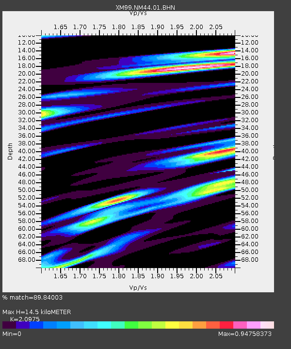
| Arrivals | |
| Ps | 2.5 SECOND |
| PpPs | 6.8 SECOND |
| PsPs/PpSs | 9.3 SECOND |

