MB04B Magmabody04b - Earthquake Result Viewer
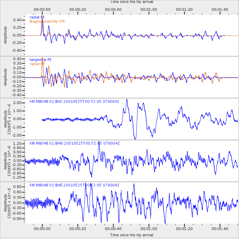
Earthquake location: Kuril Islands
Earthquake latitude/longitude: 44.3/148.4
Earthquake time(UTC): 2001/05/25 (145) 00:40:50 GMT
Earthquake Depth: 33 km
Earthquake Magnitude: 6.1 MB, 6.7 MS, 6.7 MW, 6.6 MW
Earthquake Catalog/Contributor: WHDF/NEIC
Network: XM Rio Grande Seismic Transect
Station: MB04B Magmabody04b
Lat/Lon: 34.07 N/106.94 W
Elevation: 1489 m
Distance: 76.3 deg
Az: 55.749 deg
Baz: 314.325 deg
Ray Param: 0.051043622
Estimated Moho Depth: 39.0 km
Estimated Crust Vp/Vs: 1.60
Assumed Crust Vp: 6.502 km/s
Estimated Crust Vs: 4.063 km/s
Estimated Crust Poisson's Ratio: 0.18
Radial Match: 92.07567 %
Radial Bump: 400
Transverse Match: 81.976204 %
Transverse Bump: 400
SOD ConfigId: 16820
Insert Time: 2010-02-26 17:37:24.477 +0000
GWidth: 2.5
Max Bumps: 400
Tol: 0.001

Signal To Noise

ChannelStoNSTALTA
XM:MB04B:01:BHN:20010525T00:52:05.079004Z1.22117731.1540529E-79.45033E-8
XM:MB04B:01:BHE:20010525T00:52:05.079004Z1.1362171.4839938E-71.3060831E-7
XM:MB04B:01:BHZ:20010525T00:52:05.079004Z1.68172751.3667103E-78.126824E-8
Arrivals
Ps3.7 SECOND
PpPs15 SECOND
PsPs/PpSs19 SECOND