NM40 NewMexico40 - Earthquake Result Viewer
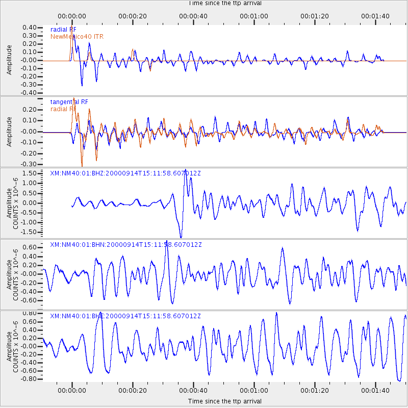
Earthquake location: Fiji Islands
Earthquake latitude/longitude: -15.7/179.8
Earthquake time(UTC): 2000/09/14 (258) 14:59:57 GMT
Earthquake Depth: 33 km
Earthquake Magnitude: 5.7 MB, 6.2 MS, 6.3 MW, 6.2 MW
Earthquake Catalog/Contributor: WHDF/NEIC
Network: XM Rio Grande Seismic Transect
Station: NM40 NewMexico40
Lat/Lon: 35.95 N/108.43 W
Elevation: 1796 m
Distance: 85.0 deg
Az: 50.682 deg
Baz: 246.651 deg
Ray Param: 0.045023847
Estimated Moho Depth: 13.0 km
Estimated Crust Vp/Vs: 2.07
Assumed Crust Vp: 6.496 km/s
Estimated Crust Vs: 3.138 km/s
Estimated Crust Poisson's Ratio: 0.35
Radial Match: 88.82893 %
Radial Bump: 296
Transverse Match: 59.395897 %
Transverse Bump: 400
SOD ConfigId: 16820
Insert Time: 2010-02-26 17:37:42.062 +0000
GWidth: 2.5
Max Bumps: 400
Tol: 0.001

Signal To Noise

ChannelStoNSTALTA
XM:NM40:01:BHN:20000914T15:11:58.607012Z0.575795957.567142E-81.3142055E-7
XM:NM40:01:BHE:20000914T15:11:58.607012Z0.646143261.5483971E-72.3963682E-7
XM:NM40:01:BHZ:20000914T15:11:58.607012Z2.77584623.3492685E-71.2065756E-7
Arrivals
Ps2.2 SECOND
PpPs6.0 SECOND
PsPs/PpSs8.2 SECOND