NM39 NewMexico39 - Earthquake Result Viewer
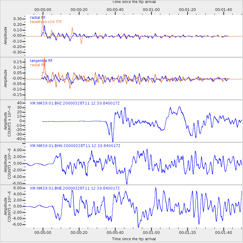
Earthquake location: Volcano Islands, Japan Region
Earthquake latitude/longitude: 22.3/143.7
Earthquake time(UTC): 2000/03/28 (088) 11:00:22 GMT
Earthquake Depth: 126 km
Earthquake Magnitude: 6.8 MB, 7.6 MS, 7.6 MW, 7.6 MW
Earthquake Catalog/Contributor: WHDF/NEIC
Network: XM Rio Grande Seismic Transect
Station: NM39 NewMexico39
Lat/Lon: 35.79 N/108.27 W
Elevation: 1949 m
Distance: 90.7 deg
Az: 50.647 deg
Baz: 298.286 deg
Ray Param: 0.04162734
Estimated Moho Depth: 13.0 km
Estimated Crust Vp/Vs: 1.90
Assumed Crust Vp: 6.496 km/s
Estimated Crust Vs: 3.423 km/s
Estimated Crust Poisson's Ratio: 0.31
Radial Match: 96.58184 %
Radial Bump: 400
Transverse Match: 88.606224 %
Transverse Bump: 400
SOD ConfigId: 27569
Insert Time: 2010-02-26 17:37:55.311 +0000
GWidth: 2.5
Max Bumps: 400
Tol: 0.001

Signal To Noise

ChannelStoNSTALTA
XM:NM39:01:BHN:20000328T11:12:39.840017Z0.974485751.8268315E-71.8746621E-7
XM:NM39:01:BHE:20000328T11:12:39.840017Z1.17213891.79975E-71.5354408E-7
XM:NM39:01:BHZ:20000328T11:12:39.840017Z1.39691474.506699E-73.2261804E-7
Arrivals
Ps1.8 SECOND
PpPs5.7 SECOND
PsPs/PpSs7.5 SECOND