NM39 NewMexico39 - Earthquake Result Viewer
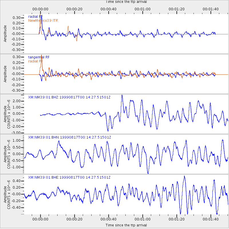
Earthquake location: Turkey
Earthquake latitude/longitude: 40.7/29.9
Earthquake time(UTC): 1999/08/17 (229) 00:01:39 GMT
Earthquake Depth: 17 km
Earthquake Magnitude: 6.3 MB, 7.8 MS, 7.7 ME, 7.6 MW
Earthquake Catalog/Contributor: WHDF/NEIC
Network: XM Rio Grande Seismic Transect
Station: NM39 NewMexico39
Lat/Lon: 35.79 N/108.27 W
Elevation: 1949 m
Distance: 94.7 deg
Az: 327.015 deg
Baz: 30.582 deg
Ray Param: 0.040982928
Estimated Moho Depth: 12.0 km
Estimated Crust Vp/Vs: 1.85
Assumed Crust Vp: 6.496 km/s
Estimated Crust Vs: 3.511 km/s
Estimated Crust Poisson's Ratio: 0.29
Radial Match: 89.525024 %
Radial Bump: 354
Transverse Match: 81.95193 %
Transverse Bump: 392
SOD ConfigId: 27569
Insert Time: 2010-02-26 17:38:15.121 +0000
GWidth: 2.5
Max Bumps: 400
Tol: 0.001

Signal To Noise

ChannelStoNSTALTA
XM:NM39:01:BHN:19990817T00:14:27.51501Z1.53107512.160672E-71.4112123E-7
XM:NM39:01:BHE:19990817T00:14:27.51501Z0.674510964.5396646E-86.7303056E-8
XM:NM39:01:BHZ:19990817T00:14:27.51501Z2.17481372.0170945E-79.2747925E-8
Arrivals
Ps1.6 SECOND
PpPs5.2 SECOND
PsPs/PpSs6.8 SECOND