
NM38 NewMexico38 - Earthquake Result Viewer
| ||||||||||||||||||
| ||||||||||||||||||
| ||||||||||||||||||
|
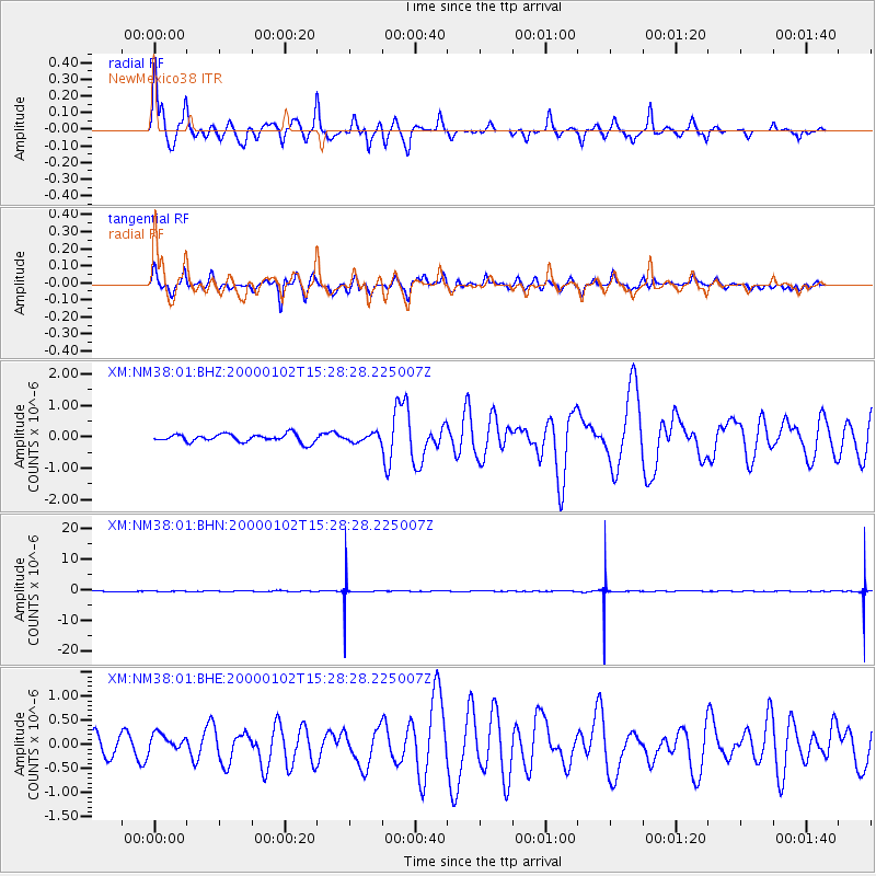
Signal To Noise
| Channel | StoN | STA | LTA |
| XM:NM38:01:BHN:20000102T15:28:28.225007Z | 0.04294531 | 6.8849E-8 | 1.6031784E-6 |
| XM:NM38:01:BHE:20000102T15:28:28.225007Z | 0.9108908 | 1.7286813E-7 | 1.897792E-7 |
| XM:NM38:01:BHZ:20000102T15:28:28.225007Z | 0.96116877 | 1.2114134E-7 | 1.2603546E-7 |
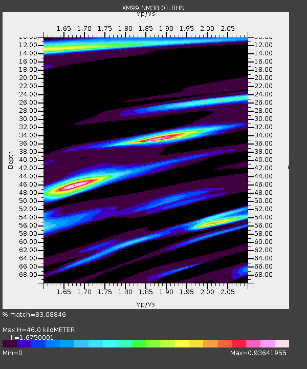
| Arrivals | |
| Ps | 4.9 SECOND |
| PpPs | 18 SECOND |
| PsPs/PpSs | 23 SECOND |

