
NM38 NewMexico38 - Earthquake Result Viewer
| ||||||||||||||||||
| ||||||||||||||||||
| ||||||||||||||||||
|
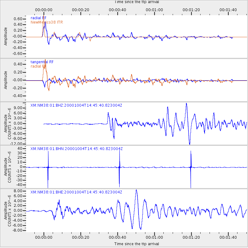
Signal To Noise
| Channel | StoN | STA | LTA |
| XM:NM38:01:BHN:20001004T14:45:40.823004Z | 53.732403 | 6.7202864E-6 | 1.2506953E-7 |
| XM:NM38:01:BHE:20001004T14:45:40.823004Z | 1.9606597 | 2.9828212E-7 | 1.5213355E-7 |
| XM:NM38:01:BHZ:20001004T14:45:40.823004Z | 7.8109183 | 9.732873E-7 | 1.24606E-7 |
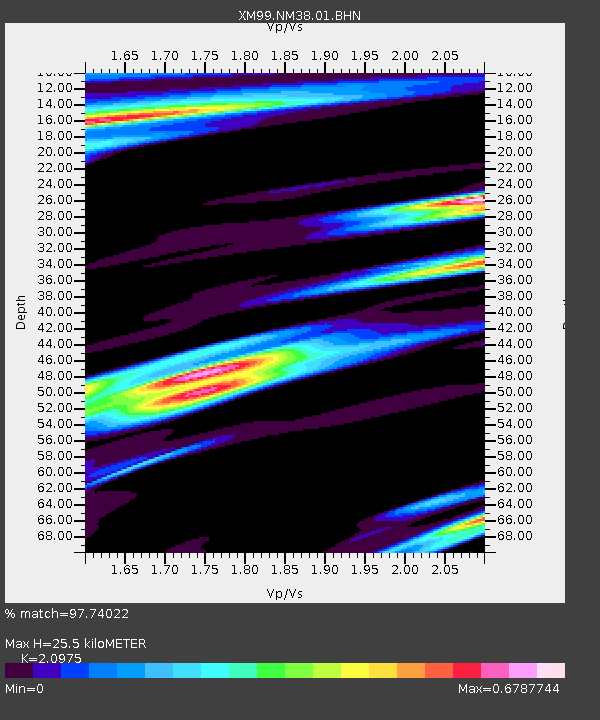
| Arrivals | |
| Ps | 4.5 SECOND |
| PpPs | 12 SECOND |
| PsPs/PpSs | 16 SECOND |

