
NM38 NewMexico38 - Earthquake Result Viewer
| ||||||||||||||||||
| ||||||||||||||||||
| ||||||||||||||||||
|
Signal To Noise
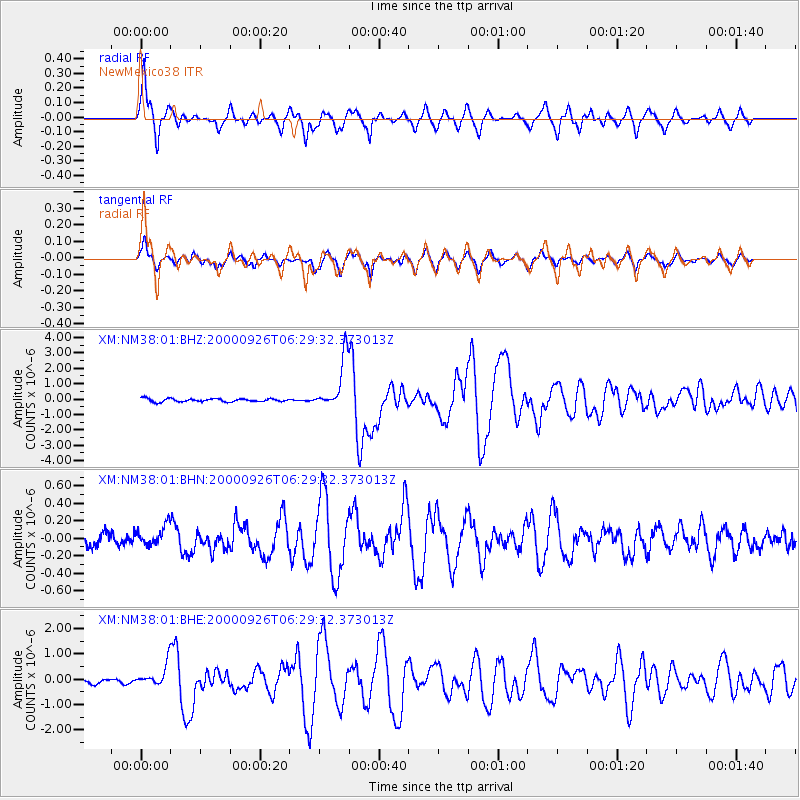
| Channel | StoN | STA | LTA |
| XM:NM38:01:BHN:20000926T06:29:32.373013Z | 1.8253931 | 1.191023E-7 | 6.5247484E-8 |
| XM:NM38:01:BHE:20000926T06:29:32.373013Z | 4.0906916 | 4.262497E-7 | 1.0419991E-7 |
| XM:NM38:01:BHZ:20000926T06:29:32.373013Z | 15.881445 | 1.6390028E-6 | 1.0320237E-7 |
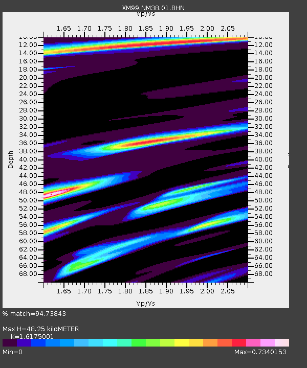
| Arrivals | |
| Ps | 4.7 SECOND |
| PpPs | 19 SECOND |
| PsPs/PpSs | 24 SECOND |

