
NM38 NewMexico38 - Earthquake Result Viewer
| ||||||||||||||||||
| ||||||||||||||||||
| ||||||||||||||||||
|
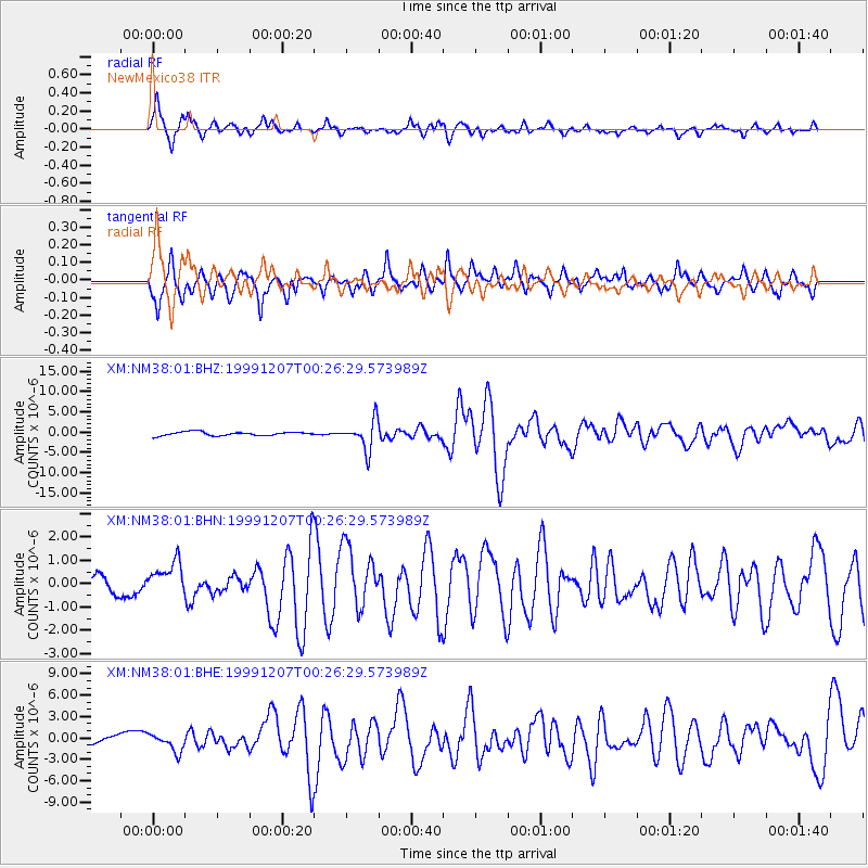
Signal To Noise
| Channel | StoN | STA | LTA |
| XM:NM38:01:BHN:19991207T00:26:29.573989Z | 2.0903208 | 7.564297E-7 | 3.6187254E-7 |
| XM:NM38:01:BHE:19991207T00:26:29.573989Z | 2.4813266 | 1.2221142E-6 | 4.925246E-7 |
| XM:NM38:01:BHZ:19991207T00:26:29.573989Z | 7.9583383 | 3.6203608E-6 | 4.5491416E-7 |
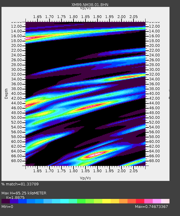
| Arrivals | |
| Ps | 9.6 SECOND |
| PpPs | 27 SECOND |
| PsPs/PpSs | 37 SECOND |

