UQSK XI.UQSK - Earthquake Result Viewer
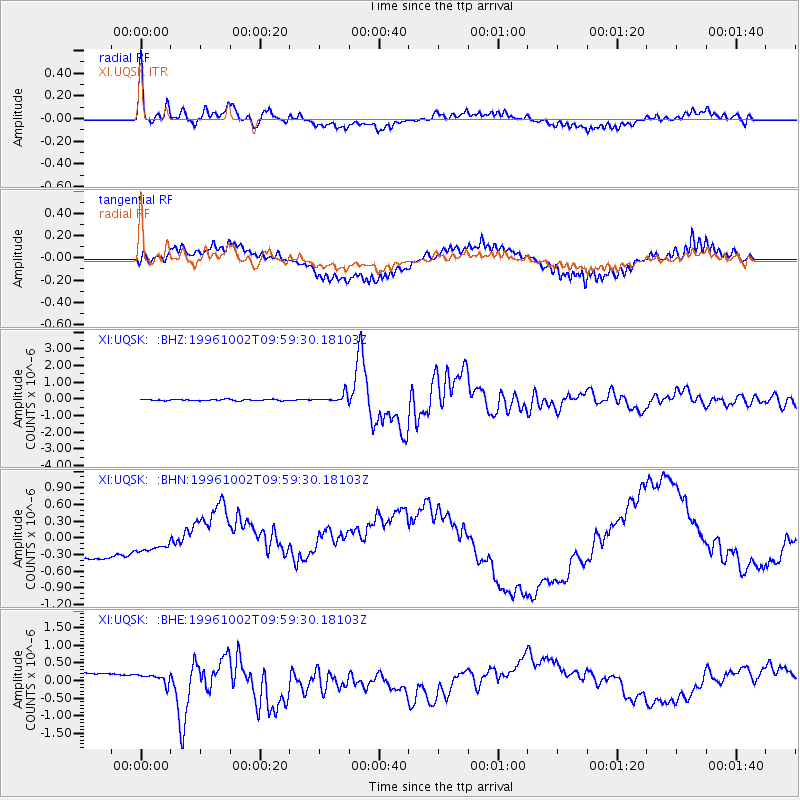
Earthquake location: Samar, Philippines
Earthquake latitude/longitude: 11.8/125.5
Earthquake time(UTC): 1996/10/02 (276) 09:48:01 GMT
Earthquake Depth: 33 km
Earthquake Magnitude: 6.0 MB, 6.4 MS, 6.4 UNKNOWN, 6.3 MW
Earthquake Catalog/Contributor: WHDF/NEIC
Network: XI Saudi Arabia Broadband Array
Station: UQSK XI.UQSK
Lat/Lon: 25.79 N/42.36 E
Elevation: 950 m
Distance: 78.9 deg
Az: 294.179 deg
Baz: 82.277 deg
Ray Param: 0.049314924
Estimated Moho Depth: 36.25 km
Estimated Crust Vp/Vs: 1.80
Assumed Crust Vp: 6.642 km/s
Estimated Crust Vs: 3.7 km/s
Estimated Crust Poisson's Ratio: 0.27
Radial Match: 84.771324 %
Radial Bump: 400
Transverse Match: 64.59899 %
Transverse Bump: 400
SOD ConfigId: 6273
Insert Time: 2010-03-09 23:44:28.882 +0000
GWidth: 2.5
Max Bumps: 400
Tol: 0.001

Signal To Noise

ChannelStoNSTALTA
XI:UQSK: :BHN:19961002T09:59:30.18103Z0.504520063.1710283E-76.285237E-7
XI:UQSK: :BHE:19961002T09:59:30.18103Z0.53990631.7692665E-73.276988E-7
XI:UQSK: :BHZ:19961002T09:59:30.18103Z6.8770212.5494217E-73.7071597E-8
Arrivals
Ps4.5 SECOND
PpPs15 SECOND
PsPs/PpSs19 SECOND