UQSK XI.UQSK - Earthquake Result Viewer
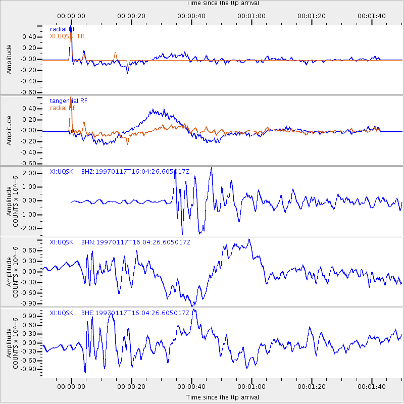
Earthquake location: Ryukyu Islands, Japan
Earthquake latitude/longitude: 28.8/130.0
Earthquake time(UTC): 1997/01/17 (017) 15:53:13 GMT
Earthquake Depth: 33 km
Earthquake Magnitude: 5.9 MB, 6.3 MS, 6.3 UNKNOWN, 6.2 MW
Earthquake Catalog/Contributor: WHDF/NEIC
Network: XI Saudi Arabia Broadband Array
Station: UQSK XI.UQSK
Lat/Lon: 25.79 N/42.36 E
Elevation: 950 m
Distance: 76.1 deg
Az: 291.87 deg
Baz: 64.6 deg
Ray Param: 0.05119323
Estimated Moho Depth: 38.5 km
Estimated Crust Vp/Vs: 1.74
Assumed Crust Vp: 6.642 km/s
Estimated Crust Vs: 3.812 km/s
Estimated Crust Poisson's Ratio: 0.25
Radial Match: 85.18389 %
Radial Bump: 400
Transverse Match: 67.623085 %
Transverse Bump: 400
SOD ConfigId: 6273
Insert Time: 2010-03-09 23:44:35.113 +0000
GWidth: 2.5
Max Bumps: 400
Tol: 0.001

Signal To Noise

ChannelStoNSTALTA
XI:UQSK: :BHN:19970117T16:04:26.605017Z1.43773812.3098553E-71.6065898E-7
XI:UQSK: :BHE:19970117T16:04:26.605017Z1.47467023.6474418E-72.473395E-7
XI:UQSK: :BHZ:19970117T16:04:26.605017Z9.0815927.439732E-78.192102E-8
Arrivals
Ps4.5 SECOND
PpPs15 SECOND
PsPs/PpSs20 SECOND