GOBA Goba - Earthquake Result Viewer
Earthquake location: Banda Sea
Earthquake latitude/longitude: -6.9/128.9
Earthquake time(UTC): 2001/11/20 (324) 21:08:18 GMT
Earthquake Depth: 33 km
Earthquake Magnitude: 5.7 MB, 6.0 MS, 6.3 MW, 6.2 MW
Earthquake Catalog/Contributor: WHDF/NEIC
Network: XI Ethiopia/Kenya Broadband Seismic Experiment
Station: GOBA Goba
Lat/Lon: 7.03 N/39.98 E
Elevation: 2732 m
Distance: 89.8 deg
Az: 277.057 deg
Baz: 96.912 deg
Ray Param: 0.041716114
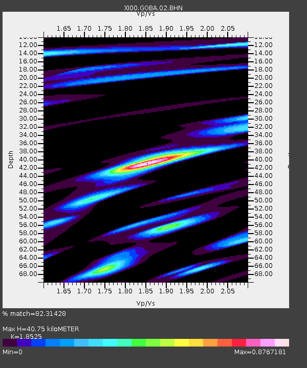
Estimated Moho Depth: 40.75 km
Estimated Crust Vp/Vs: 1.85
Assumed Crust Vp: 6.464 km/s
Estimated Crust Vs: 3.489 km/s
Estimated Crust Poisson's Ratio: 0.29
Radial Match: 82.31428 %
Radial Bump: 400
Transverse Match: 58.586426 %
Transverse Bump: 400
SOD ConfigId: 16820
Insert Time: 2010-03-09 23:48:26.344 +0000
GWidth: 2.5
Max Bumps: 400
Tol: 0.001

Signal To Noise

ChannelStoNSTALTA
XI:GOBA:02:BHN:20011120T21:20:42.286018Z1.97014198.409608E-84.268529E-8
XI:GOBA:02:BHE:20011120T21:20:42.286018Z0.93434644.8647394E-85.2065698E-8
XI:GOBA:02:BHZ:20011120T21:20:42.286018Z0.684984565.8475916E-88.536823E-8
Arrivals
Ps5.5 SECOND
PpPs18 SECOND
PsPs/PpSs23 SECOND