
NM37 NewMexico37 - Earthquake Result Viewer
| ||||||||||||||||||
| ||||||||||||||||||
| ||||||||||||||||||
|
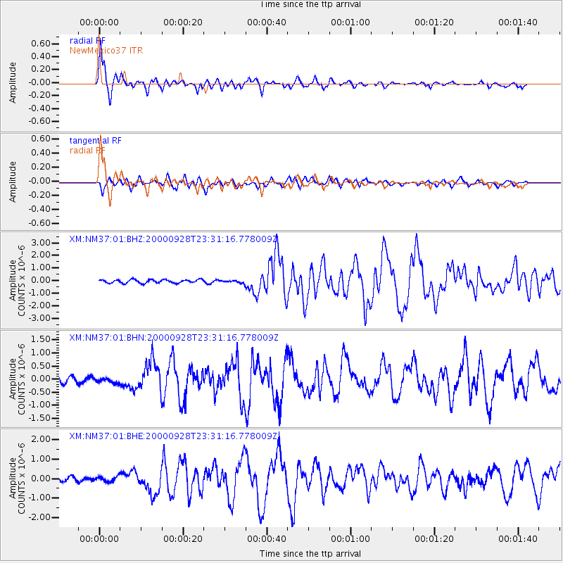
Signal To Noise
| Channel | StoN | STA | LTA |
| XM:NM37:01:BHN:20000928T23:31:16.778009Z | 0.67977214 | 1.1966318E-7 | 1.7603425E-7 |
| XM:NM37:01:BHE:20000928T23:31:16.778009Z | 1.3153783 | 1.4334783E-7 | 1.0897841E-7 |
| XM:NM37:01:BHZ:20000928T23:31:16.778009Z | 0.78098214 | 1.0313658E-7 | 1.320601E-7 |
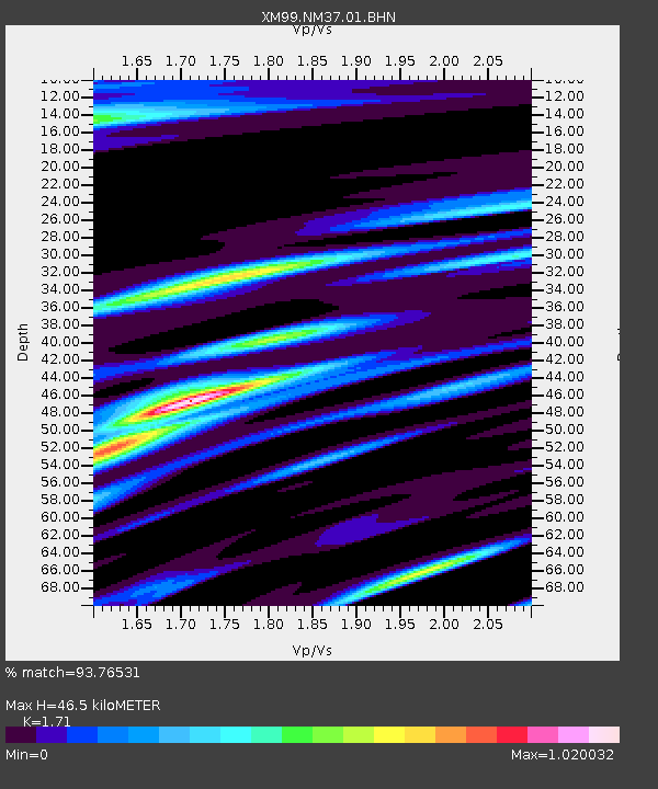
| Arrivals | |
| Ps | 5.4 SECOND |
| PpPs | 18 SECOND |
| PsPs/PpSs | 24 SECOND |

