
MM02 Hudson, New York - Earthquake Result Viewer
| ||||||||||||||||||
| ||||||||||||||||||
| ||||||||||||||||||
|
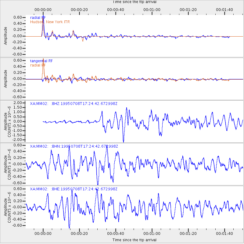
Signal To Noise
| Channel | StoN | STA | LTA |
| XA:MM02: :BHN:19950708T17:24:42.672998Z | 3.0716631 | 2.2231926E-7 | 7.237748E-8 |
| XA:MM02: :BHE:19950708T17:24:42.672998Z | 3.2720437 | 2.1490672E-7 | 6.5679664E-8 |
| XA:MM02: :BHZ:19950708T17:24:42.672998Z | 9.003922 | 5.8779807E-7 | 6.528245E-8 |
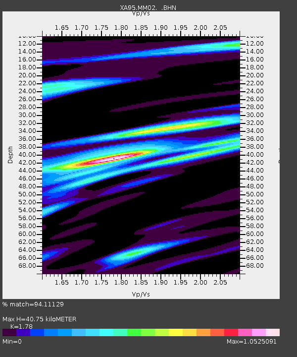
| Arrivals | |
| Ps | 5.2 SECOND |
| PpPs | 17 SECOND |
| PsPs/PpSs | 22 SECOND |

