
MM02 Hudson, New York - Earthquake Result Viewer
| ||||||||||||||||||
| ||||||||||||||||||
| ||||||||||||||||||
|
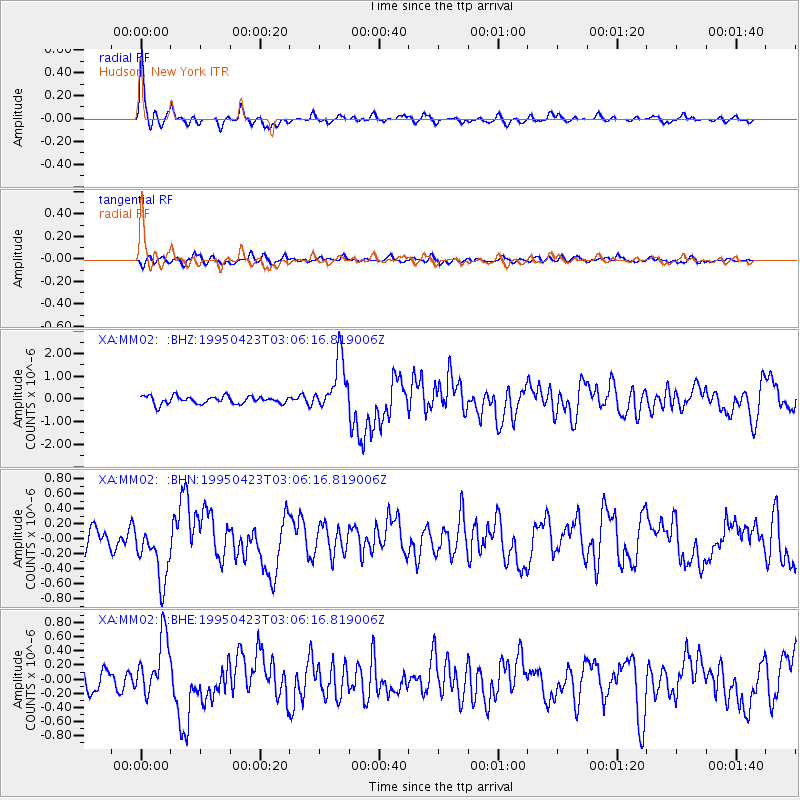
Signal To Noise
| Channel | StoN | STA | LTA |
| XA:MM02: :BHN:19950423T03:06:16.819006Z | 2.7134476 | 3.800476E-7 | 1.4006078E-7 |
| XA:MM02: :BHE:19950423T03:06:16.819006Z | 2.72989 | 4.206396E-7 | 1.5408664E-7 |
| XA:MM02: :BHZ:19950423T03:06:16.819006Z | 6.9727926 | 1.1677732E-6 | 1.6747568E-7 |
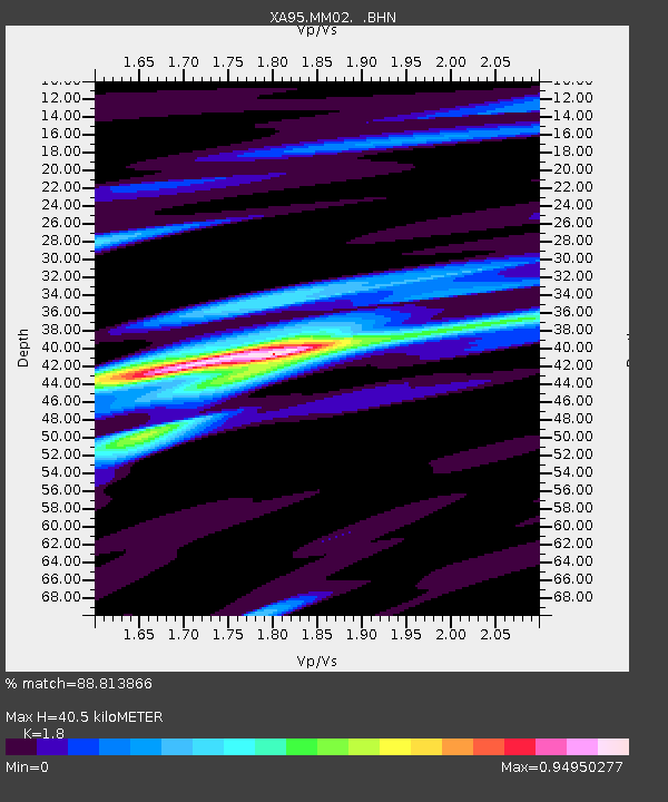
| Arrivals | |
| Ps | 5.2 SECOND |
| PpPs | 17 SECOND |
| PsPs/PpSs | 22 SECOND |

