You are here: Home > Network List > XA95 - Missouri to Massachusetts Transect Stations List
> Station MM02 Hudson, New York > Earthquake Result Viewer
MM02 Hudson, New York - Earthquake Result Viewer

| Earthquake location: |
Northern Peru |
| Earthquake latitude/longitude: |
-3.9/-77.0 |
| Earthquake time(UTC): |
1995/05/02 (122) 06:06:05 GMT |
| Earthquake Depth: |
103 km |
| Earthquake Magnitude: |
6.5 MB, 6.7 UNKNOWN, 6.6 MW |
| Earthquake Catalog/Contributor: |
WHDF/NEIC |
|
| Network: |
XA Missouri to Massachusetts Transect |
| Station: |
MM02 Hudson, New York |
| Lat/Lon: |
42.17 N/73.72 W |
| Elevation: |
134 m |
|
| Distance: |
45.9 deg |
| Az: |
3.354 deg |
| Baz: |
184.503 deg |
| Ray Param: |
0.07064148 |
| Estimated Moho Depth: |
34.0 km |
| Estimated Crust Vp/Vs: |
2.08 |
| Assumed Crust Vp: |
6.419 km/s |
| Estimated Crust Vs: |
3.082 km/s |
| Estimated Crust Poisson's Ratio: |
0.35 |
|
| Radial Match: |
87.02123 % |
| Radial Bump: |
373 |
| Transverse Match: |
68.25777 % |
| Transverse Bump: |
400 |
| SOD ConfigId: |
6273 |
| Insert Time: |
2010-02-26 17:43:16.240 +0000 |
| GWidth: |
2.5 |
| Max Bumps: |
400 |
| Tol: |
0.001 |
|
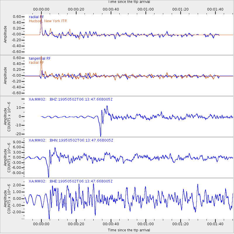
Signal To Noise
| Channel | StoN | STA | LTA |
| XA:MM02: :BHN:19950502T06:13:47.668005Z | 6.0219483 | 3.828172E-6 | 6.357032E-7 |
| XA:MM02: :BHE:19950502T06:13:47.668005Z | 2.4446995 | 1.1226524E-6 | 4.5921897E-7 |
| XA:MM02: :BHZ:19950502T06:13:47.668005Z | 12.752983 | 7.1309237E-6 | 5.5915734E-7 |
| Arrivals |
| Ps | 6.0 SECOND |
| PpPs | 15 SECOND |
| PsPs/PpSs | 22 SECOND |


