
MM02 Hudson, New York - Earthquake Result Viewer
| ||||||||||||||||||
| ||||||||||||||||||
| ||||||||||||||||||
|
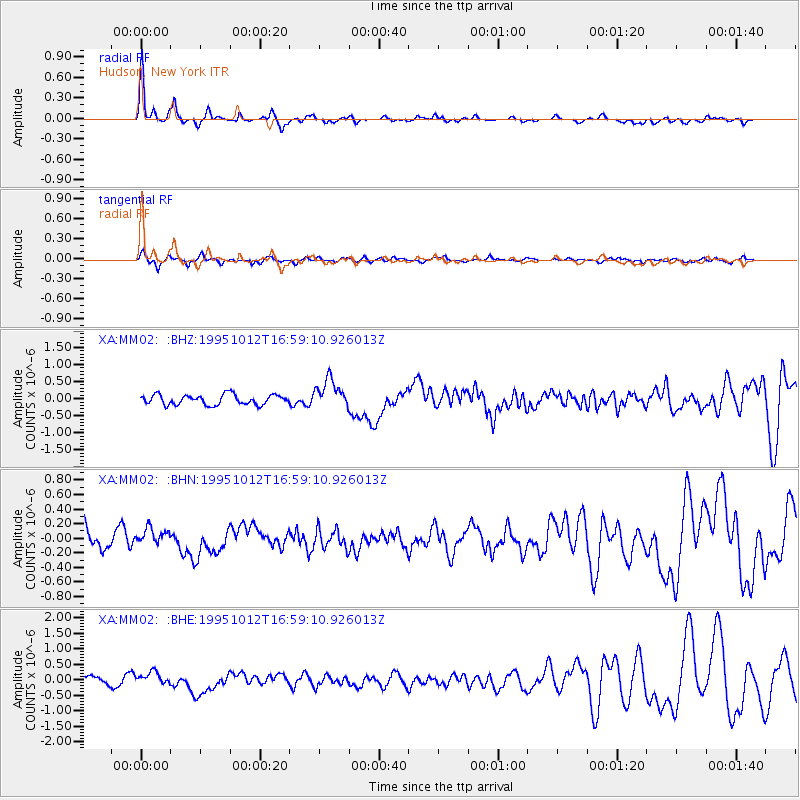
Signal To Noise
| Channel | StoN | STA | LTA |
| XA:MM02: :BHN:19951012T16:59:10.926013Z | 0.8800587 | 1.187872E-7 | 1.3497645E-7 |
| XA:MM02: :BHE:19951012T16:59:10.926013Z | 1.7477599 | 2.18495E-7 | 1.2501431E-7 |
| XA:MM02: :BHZ:19951012T16:59:10.926013Z | 2.8869722 | 4.2191255E-7 | 1.461436E-7 |
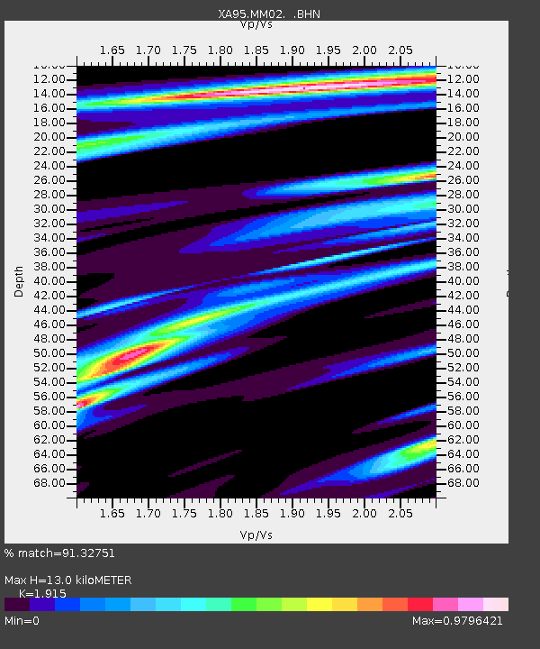
| Arrivals | |
| Ps | 2.0 SECOND |
| PpPs | 5.5 SECOND |
| PsPs/PpSs | 7.5 SECOND |

