MM02 Hudson, New York - Earthquake Result Viewer
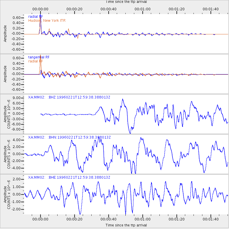
Earthquake location: Off Coast Of Northern Peru
Earthquake latitude/longitude: -9.6/-79.6
Earthquake time(UTC): 1996/02/21 (052) 12:51:04 GMT
Earthquake Depth: 33 km
Earthquake Magnitude: 5.8 MB, 6.6 MS, 7.5 UNKNOWN, 7.3 MW
Earthquake Catalog/Contributor: WHDF/NEIC
Network: XA Missouri to Massachusetts Transect
Station: MM02 Hudson, New York
Lat/Lon: 42.17 N/73.72 W
Elevation: 134 m
Distance: 51.8 deg
Az: 5.532 deg
Baz: 187.346 deg
Ray Param: 0.067105696
Estimated Moho Depth: 35.5 km
Estimated Crust Vp/Vs: 1.90
Assumed Crust Vp: 6.419 km/s
Estimated Crust Vs: 3.383 km/s
Estimated Crust Poisson's Ratio: 0.31
Radial Match: 97.682816 %
Radial Bump: 331
Transverse Match: 81.92047 %
Transverse Bump: 400
SOD ConfigId: 6273
Insert Time: 2010-02-26 17:43:28.293 +0000
GWidth: 2.5
Max Bumps: 400
Tol: 0.001

Signal To Noise

ChannelStoNSTALTA
XA:MM02: :BHN:19960221T12:59:38.388013Z3.34021626.065918E-71.8160256E-7
XA:MM02: :BHE:19960221T12:59:38.388013Z1.66055745.025434E-73.0263539E-7
XA:MM02: :BHZ:19960221T12:59:38.388013Z6.84726141.4250354E-62.0811757E-7
Arrivals
Ps5.2 SECOND
PpPs15 SECOND
PsPs/PpSs20 SECOND