You are here: Home > Network List > IC - New China Digital Seismograph Network Stations List
> Station HIA Hailar, Neimenggu Autonomous Region, China > Earthquake Result Viewer
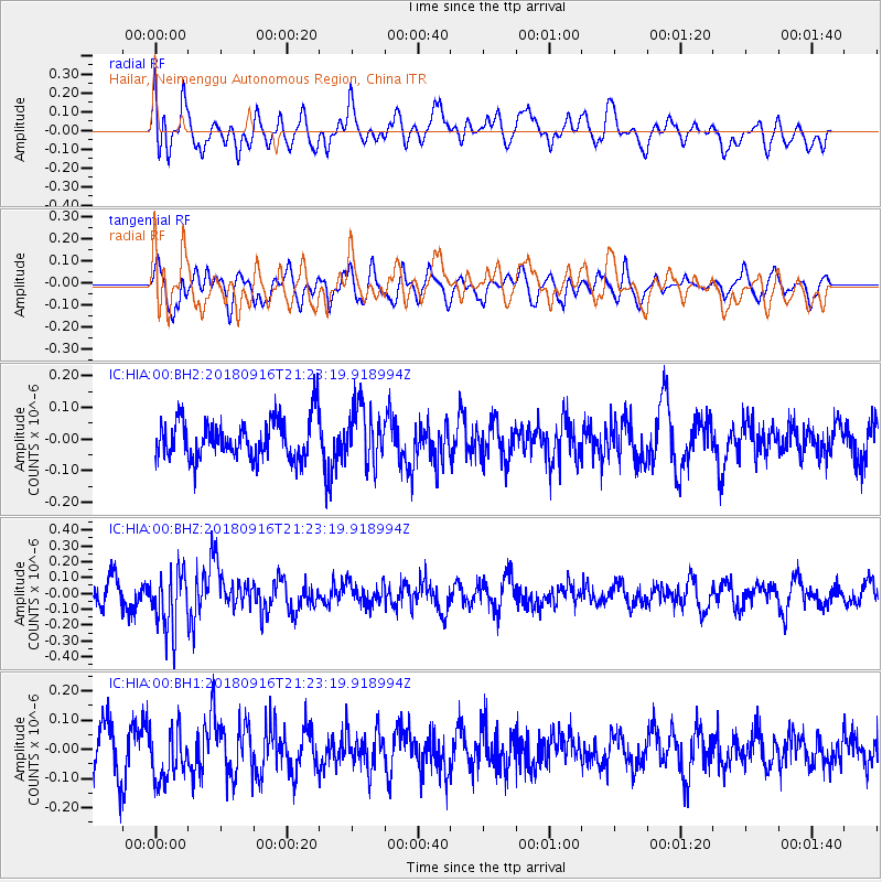
HIA Hailar, Neimenggu Autonomous Region, China - Earthquake Result Viewer
*The percent match for this event was below the threshold and hence no stack was calculated.
| Earthquake location: |
South Of Fiji Islands |
| Earthquake latitude/longitude: |
-25.5/178.2 |
| Earthquake time(UTC): |
2018/09/16 (259) 21:11:48 GMT |
| Earthquake Depth: |
570 km |
| Earthquake Magnitude: |
6.5 Mww |
| Earthquake Catalog/Contributor: |
NEIC PDE/us |
|
| Network: |
IC New China Digital Seismograph Network |
| Station: |
HIA Hailar, Neimenggu Autonomous Region, China |
| Lat/Lon: |
49.27 N/119.74 E |
| Elevation: |
620 m |
|
| Distance: |
90.8 deg |
| Az: |
326.055 deg |
| Baz: |
129.581 deg |
| Ray Param: |
$rayparam |
*The percent match for this event was below the threshold and hence was not used in the summary stack. |
|
| Radial Match: |
51.494488 % |
| Radial Bump: |
400 |
| Transverse Match: |
54.443466 % |
| Transverse Bump: |
400 |
| SOD ConfigId: |
2825771 |
| Insert Time: |
2018-09-30 21:24:13.304 +0000 |
| GWidth: |
2.5 |
| Max Bumps: |
400 |
| Tol: |
0.001 |
|
Signal To Noise
| Channel | StoN | STA | LTA |
| IC:HIA:00:BHZ:20180916T21:23:19.918994Z | 2.9881604 | 1.8107434E-7 | 6.0597266E-8 |
| IC:HIA:00:BH1:20180916T21:23:19.918994Z | 1.0112383 | 8.6582666E-8 | 8.5620435E-8 |
| IC:HIA:00:BH2:20180916T21:23:19.918994Z | 1.4823512 | 9.12855E-8 | 6.158156E-8 |
| Arrivals |
| Ps | |
| PpPs | |
| PsPs/PpSs | |


