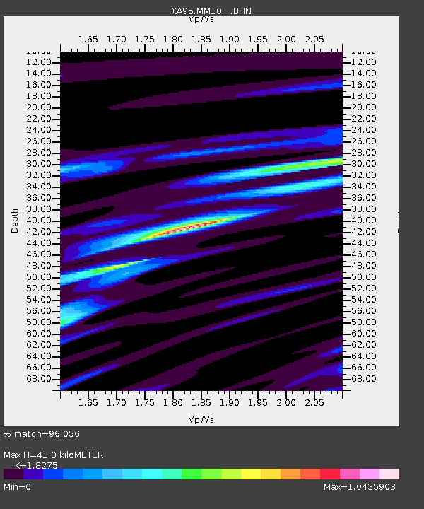
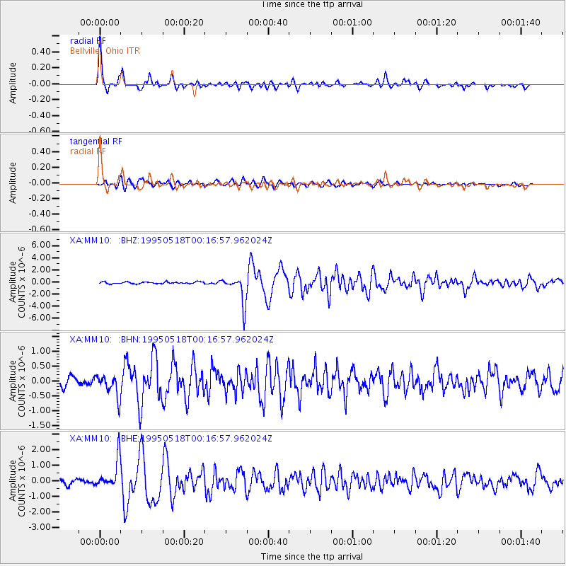
MM10 Bellville, Ohio - Earthquake Result Viewer

Earthquake location: Central Mid-Atlantic Ridge
Earthquake latitude/longitude: -0.9/-22.0
Earthquake time(UTC): 1995/05/18 (138) 00:06:26 GMT
Earthquake Depth: 10 km
Earthquake Magnitude: 6.2 MB, 6.1 MS, 6.8 UNKNOWN, 6.7 MW
Earthquake Catalog/Contributor: WHDF/NEIC
Network: XA Missouri to Massachusetts Transect
Station: MM10 Bellville, Ohio
Lat/Lon: 40.61 N/82.30 W
Elevation: 346 m
Distance: 68.5 deg
Az: 314.704 deg
Baz: 111.008 deg
Ray Param: 0.056252483
Estimated Moho Depth: 41.0 km
Estimated Crust Vp/Vs: 1.83
Assumed Crust Vp: 6.498 km/s
Estimated Crust Vs: 3.555 km/s
Estimated Crust Poisson's Ratio: 0.29
Radial Match: 96.056 %
Radial Bump: 389
Transverse Match: 84.140045 %
Transverse Bump: 400
SOD ConfigId: 6273
Insert Time: 2010-02-26 17:50:43.569 +0000
GWidth: 2.5
Max Bumps: 400
Tol: 0.001

Signal To Noise

ChannelStoNSTALTA
XA:MM10: :BHN:19950518T00:16:57.962024Z2.74253.896099E-71.4206377E-7
XA:MM10: :BHE:19950518T00:16:57.962024Z6.1810759.877184E-71.5979718E-7
XA:MM10: :BHZ:19950518T00:16:57.962024Z16.3981972.3830207E-61.4532212E-7
Arrivals
Ps5.4 SECOND
PpPs17 SECOND
PsPs/PpSs23 SECOND