You are here: Home > Network List > XA95 - Missouri to Massachusetts Transect Stations List
> Station MM10 Bellville, Ohio > Earthquake Result Viewer
MM10 Bellville, Ohio - Earthquake Result Viewer

| Earthquake location: |
Colombia |
| Earthquake latitude/longitude: |
4.2/-76.6 |
| Earthquake time(UTC): |
1995/02/08 (039) 18:40:25 GMT |
| Earthquake Depth: |
69 km |
| Earthquake Magnitude: |
6.3 MB, 6.4 UNKNOWN, 6.0 MD |
| Earthquake Catalog/Contributor: |
WHDF/NEIC |
|
| Network: |
XA Missouri to Massachusetts Transect |
| Station: |
MM10 Bellville, Ohio |
| Lat/Lon: |
40.61 N/82.30 W |
| Elevation: |
346 m |
|
| Distance: |
36.6 deg |
| Az: |
352.775 deg |
| Baz: |
170.516 deg |
| Ray Param: |
0.076367505 |
| Estimated Moho Depth: |
42.5 km |
| Estimated Crust Vp/Vs: |
1.75 |
| Assumed Crust Vp: |
6.498 km/s |
| Estimated Crust Vs: |
3.713 km/s |
| Estimated Crust Poisson's Ratio: |
0.26 |
|
| Radial Match: |
93.15985 % |
| Radial Bump: |
400 |
| Transverse Match: |
78.34792 % |
| Transverse Bump: |
400 |
| SOD ConfigId: |
6273 |
| Insert Time: |
2010-02-26 17:50:53.953 +0000 |
| GWidth: |
2.5 |
| Max Bumps: |
400 |
| Tol: |
0.001 |
|
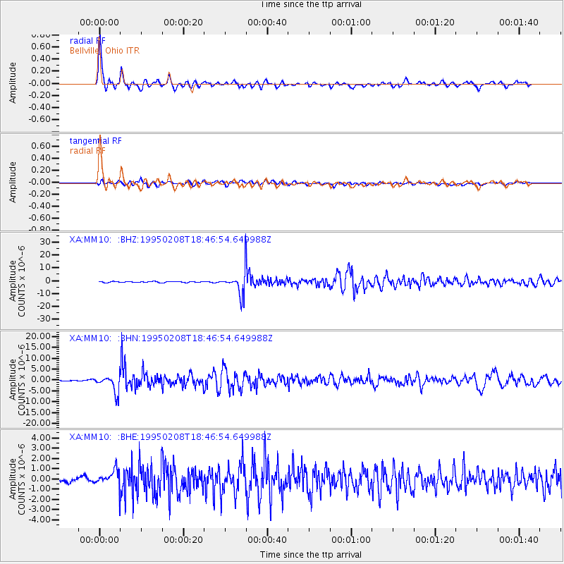
Signal To Noise
| Channel | StoN | STA | LTA |
| XA:MM10: :BHN:19950208T18:46:54.649988Z | 14.939308 | 4.130018E-6 | 2.764531E-7 |
| XA:MM10: :BHE:19950208T18:46:54.649988Z | 3.070679 | 8.879189E-7 | 2.8916043E-7 |
| XA:MM10: :BHZ:19950208T18:46:54.649988Z | 24.769953 | 9.388876E-6 | 3.7904292E-7 |
| Arrivals |
| Ps | 5.3 SECOND |
| PpPs | 17 SECOND |
| PsPs/PpSs | 22 SECOND |


