
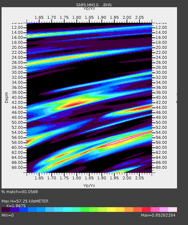
MM10 Bellville, Ohio - Earthquake Result Viewer
| ||||||||||||||||||
| ||||||||||||||||||
| ||||||||||||||||||
|
Signal To Noise
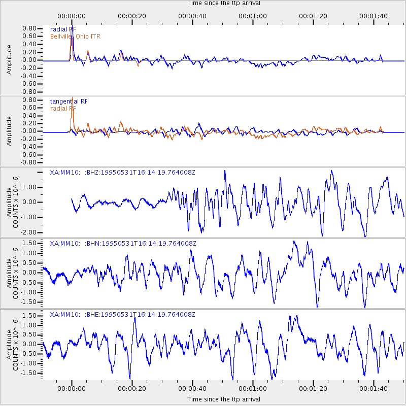
| Channel | StoN | STA | LTA |
| XA:MM10: :BHN:19950531T16:14:19.764008Z | 0.81776947 | 3.2145297E-7 | 3.930851E-7 |
| XA:MM10: :BHE:19950531T16:14:19.764008Z | 1.9549206 | 4.12517E-7 | 2.1101471E-7 |
| XA:MM10: :BHZ:19950531T16:14:19.764008Z | 1.8308544 | 4.2440792E-7 | 2.3180866E-7 |
| Arrivals | |
| Ps | 9.2 SECOND |
| PpPs | 24 SECOND |
| PsPs/PpSs | 33 SECOND |

