MM10 Bellville, Ohio - Earthquake Result Viewer
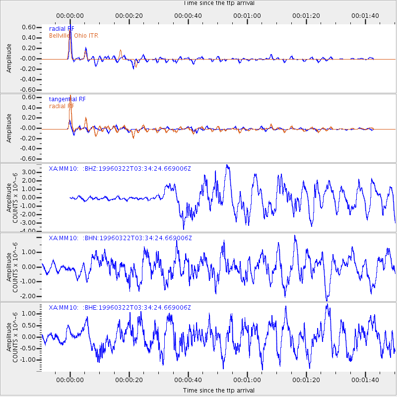
Earthquake location: Rat Islands, Aleutian Islands
Earthquake latitude/longitude: 51.2/178.7
Earthquake time(UTC): 1996/03/22 (082) 03:24:20 GMT
Earthquake Depth: 20 km
Earthquake Magnitude: 5.7 MB, 6.6 MS, 6.8 UNKNOWN, 6.6 ML
Earthquake Catalog/Contributor: WHDF/NEIC
Network: XA Missouri to Massachusetts Transect
Station: MM10 Bellville, Ohio
Lat/Lon: 40.61 N/82.30 W
Elevation: 346 m
Distance: 64.6 deg
Az: 56.355 deg
Baz: 316.551 deg
Ray Param: 0.058810692
Estimated Moho Depth: 43.25 km
Estimated Crust Vp/Vs: 1.78
Assumed Crust Vp: 6.498 km/s
Estimated Crust Vs: 3.645 km/s
Estimated Crust Poisson's Ratio: 0.27
Radial Match: 89.93215 %
Radial Bump: 300
Transverse Match: 75.19889 %
Transverse Bump: 400
SOD ConfigId: 6273
Insert Time: 2010-02-26 17:51:06.340 +0000
GWidth: 2.5
Max Bumps: 400
Tol: 0.001

Signal To Noise

ChannelStoNSTALTA
XA:MM10: :BHN:19960322T03:34:24.669006Z1.36189443.6702426E-72.694954E-7
XA:MM10: :BHE:19960322T03:34:24.669006Z1.72001672.8554987E-71.6601575E-7
XA:MM10: :BHZ:19960322T03:34:24.669006Z7.1905069.698401E-71.3487787E-7
Arrivals
Ps5.4 SECOND
PpPs18 SECOND
PsPs/PpSs23 SECOND