MM11 Columbus, Ohio - Earthquake Result Viewer
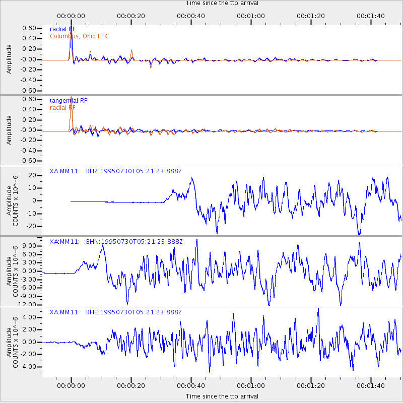
Earthquake location: Near Coast Of Northern Chile
Earthquake latitude/longitude: -23.4/-70.3
Earthquake time(UTC): 1995/07/30 (211) 05:11:23 GMT
Earthquake Depth: 47 km
Earthquake Magnitude: 6.6 MB, 7.3 MS, 7.2 UNKNOWN, 8.1 MW
Earthquake Catalog/Contributor: WHDF/NEIC
Network: XA Missouri to Massachusetts Transect
Station: MM11 Columbus, Ohio
Lat/Lon: 40.22 N/83.19 W
Elevation: 283 m
Distance: 64.4 deg
Az: 349.087 deg
Baz: 166.867 deg
Ray Param: 0.058859937
Estimated Moho Depth: 49.0 km
Estimated Crust Vp/Vs: 1.82
Assumed Crust Vp: 6.498 km/s
Estimated Crust Vs: 3.575 km/s
Estimated Crust Poisson's Ratio: 0.28
Radial Match: 98.35098 %
Radial Bump: 296
Transverse Match: 92.54663 %
Transverse Bump: 400
SOD ConfigId: 6273
Insert Time: 2010-02-26 17:51:27.893 +0000
GWidth: 2.5
Max Bumps: 400
Tol: 0.001

Signal To Noise

ChannelStoNSTALTA
XA:MM11: :BHN:19950730T05:21:23.888Z4.71017461.7344722E-63.6823948E-7
XA:MM11: :BHE:19950730T05:21:23.888Z3.8411663.3582992E-78.7429164E-8
XA:MM11: :BHZ:19950730T05:21:23.888Z20.2873784.265104E-62.1023435E-7
Arrivals
Ps6.4 SECOND
PpPs20 SECOND
PsPs/PpSs27 SECOND